Remotely monitoring protected lakes
Remotely monitoring protected lakes
Remotely measuring the historical spatial extent of Lake Preston and Lake Clifton
The Department of Water and Environmental Regulation (DWER) supports Western Australia’s community, economy and environment by managing and regulating Western Australia’s environment and water resources, which includes impacts to wetlands.
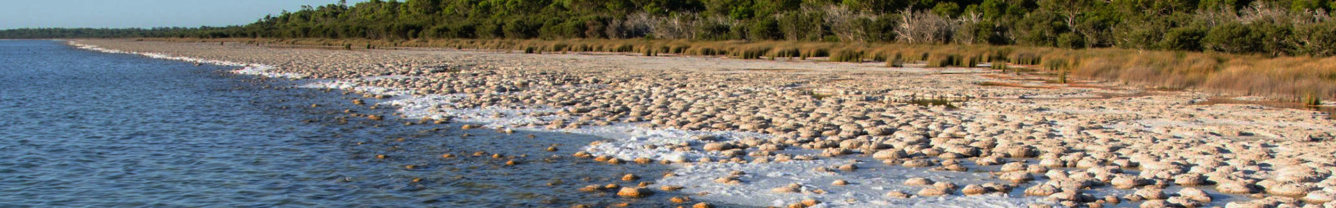
The Yalgorup National Park, in the Peel Region of Western Australia, contains a series of wetlands identified as significant for conserving biological diversity under the
Ramsar Convention. The park is home to a series of lakes that include the larger Lake Clifton and Lake Preston, with smaller satellite lakes that include Swan Pond, Lake Pollard and Lake Josephine.
Recently, DWER received concerns from local stakeholders about how much the lakes had retracted, especially considering in the past that recreational pursuits once enjoyed on the lakes, like water skiing, were no longer possible due to the significant reduction in lake water levels over time.
DWER required verification and quantification of these trends within the lake extents, and in December 2019, DWER engaged NGIS to better understand the dynamics of the lakes through the use of remote sensing.
Understanding and communicating the science behind the lake levels
The lakes within the Yalgorup National Park are important to the community for a variety of reasons, especially Aboriginal cultural values, ecological values and recreation. But with lower lake levels being noted by the local community and the need to determine the impacts of climate change and manage water use, they needed to quantify how the lakes had changed to then undertake further investigations to determine why they had changed.
“Our local community stakeholders were asking how much the lakes had retracted and what was the cause, at the time we didn’t have the data at hand to answer those questions. We needed good data and analysis,” said Adrian Goodreid, Section Manager at DWER.

“The memories, photos and anecdotes of long-term residents and visitors are always important to capture the history of such regionally iconic lakes, we wanted to support and build on this information with great science, this is where NGIS came in”
- Adrian Goodreid, Section Manager, Department of Water and Environmental regulation WA
A time series showing fluctuations of the surface extent of the lakes
The NGIS team worked in partnership with DWER to build a time series using
Google Earth Engine. The time series spanned 55 years and leveraged satellite imagery in addition to limited historical aerial imagery sourced from Landgate.
“We wanted to understand two key things in this project, the first was the changes in surface water extent over time, the second was an experimental approach to looking at water temperature through time to see how this may be useful for DWER to utilise in their future assessment of the lakes and the groundwater system,” said Sam Atkinson, General Manager of Earth Observations entity,
EO Data Science, at NGIS.
The team was able to achieve these objectives by applying a machine learning classification to the 3,048 available images. From that, they could map the extent of surface water in each lake, in every image, through time.
The result was a dataset that not only provided a means to test the key influencing factors of lake level changes through time, but also provided DWER with a data driven tool that can be used during a stakeholder consultation.
“NGIS delivered datasets and analyses that represents great innovation in interrogating old and new spatial data, and providing great visual communication tools we need for stakeholder engagement to show how the life of the lakes have changed in the last 50 to 60 years,” said Adrian.
“The lakes play a key role in how the groundwater flows and moves through the ecosystem, and by being able to incorporate the well qualified data provided by NGIS into the model, it is likely that our model calibration our predictions will be more robust - that’s been a real win and perhaps one we weren’t expecting”
- Adrian Goodreid, Section Manager, Department of Water and Environmental regulation WA
A DECISION SUPPORT TOOL WITH MANY FUTURE USES
The work completed by NGIS will be used by DWER for future community consultations regarding the status of the lakes. In addition to this, the benefit and value of the data provided has extended into DWER’s groundwater modelling efforts. The time series has been used to recreate a dataset of the lake water levels relative to seawater levels against the Australian Height Datum, which are in agreement with recent lake water level measurements.
Estimation of the key factors affecting fluctuation of lake water levels and spatial extents requires a quantitative analysis using groundwater modelling techniques. The time series NGIS created can be used, at a later stage, as calibration target in a groundwater numerical modelling to better understand the mechanisms of lake groundwater interaction and quantify the relative influence of the driving factors, including groundwater abstraction and climate control.