Transport
Enhancing operational efficiency and sustainability through geospatial insights.

Traffic Flow and Infrastructure
Working with our leading global technology partners, our deep understanding of location based services data, combined with our enterprise GIS expertise enables integration of diverse datasets, including traffic flow patterns, road infrastructure, and public transport networks, into a centralised platform with fit-for-purpose tools to enable a range of use cases. These systems support route optimisation, incident management, and long-term infrastructure planning by delivering up-to-date insights for improved decision-making. By incorporating machine learning, we enhance predictive analytics, enabling transport agencies to forecast traffic trends and identify potential bottlenecks before they occur.


Intelligent Infrastructure Monitoring
Using geospatial software engineering, we develop custom tools for tasks such as tracking vehicle movements, monitoring key transport corridors, managing road maintenance schedules, and analysing congestion hotspots. Machine learning models can be applied to automatically detect patterns in traffic data, improving the efficiency of routing and congestion management. These applications streamline workflows and improve coordination among stakeholders.
Our earth observation capabilities, combined with AI-powered analysis, allow for the monitoring of large transport networks through satellite and aerial imagery. This helps identify issues such as road degradation, vegetation encroachments, enabling organisation to streamline operations and planning. Our AI models can process and analyse this data promptly, allowing for proactive maintenance and resource allocation.


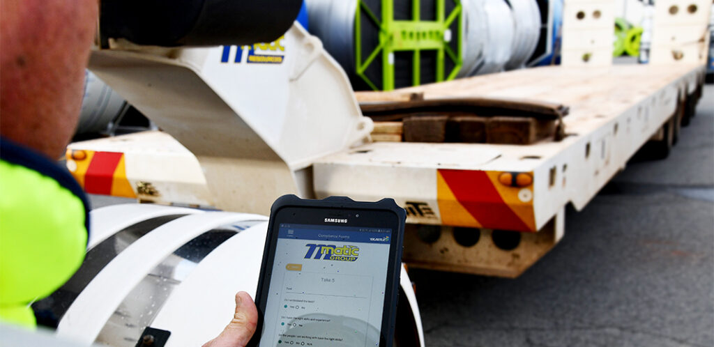
Monitor in real-time
NGIS has brought these capabilities and experiences together to create TraceMark Flow a traffic monitoring product. TraceMark Flow provides access and insights to complex location-based traffic data to deliver an operational dashboard for monitoring congestion, journey planning and management reports via a flexible web dashboard and data API.
NGIS helps organisations in the transport sector deliver highly visual, easy-to-use, safer, more efficient, and well-planned transport solutions through tailored geospatial services, whilst additionally leveraging the power of AI and machine learning to drive better decision-making.
Intelligent Transport Systems Australia
NGIS is proud to be a member of ITS Australia, the peak body for advanced transport technology, supporting the delivery of safer, more efficient, sustainable transport solutions in Australia.
Client Success Stories: Impact in Action
NGIS works with transport agencies and logistics operators to optimise infrastructure, improve safety, and enhance operational efficiency. The following case studies demonstrate how our geospatial solutions, from traffic monitoring and route optimisation to predictive maintenance and incident management, deliver measurable improvements for road networks, public transport systems, and freight operations across Australia.

How Abu Dhabi is using AI-Data to reduce traffic Congestion
NGIS was engaged by the Integrated Transport Centre (Abu Dhabi Mobility) to implement the Google traffic service TraceMark™ Flow. TraceMark™ Flow by NGIS is a next-generation traffic monitoring product designed for public sector organisations.

Scaling to meet customer demand
In 2019, EASI partnered with Liveli (a NGIS subsidiary), a Google Cloud Premier Partner for Location-based services for local technical support and to help identify opportunities where the API usage could be further optimised. Working with Liveli also meant that EASI had access to Liveli’s Volume Tier Discount pricing model to access additional cost savings.
Case studies
A Smarter Way to Manage Western Australia’s Roads
The Real Time Operations Platform (RTOP), developed by NGIS in partnership with Main Roads Western Australia, integrates data from 28 sources into a single map-centric system to enhance real-time monitoring, incident response, and road network management across Western Australia’s extensive road network, improving operational efficiency, situational awareness, and user experience for millions dailyHow Abu Dhabi is using AI-Data to reduce traffic Congestion
NGIS was engaged by the Integrated Transport Centre (Abu Dhabi Mobility) to implement the Google traffic service TraceMark™ Flow. TraceMark™ Flow by NGIS is a next-generation traffic monitoring product designed for public sector organizationsEvent and road closure planning
Using maps to communicateScaling to meet customer demand
A food delivery company experiencing rapid growth


Impact through Reach
Industries
As a global leader in the geospatial industry, our expertise spans a wide range of sectors. We believe there is no limit to the transformative power of geospatial.
Agriculture
Enabling the agricultural sector to optimise operations, improve yield predictions and enhance data-driven decision-making.
Resources
Empowering the resources sector with technology, insights, and real-time visualisations into their operations.

Transport
Delivering innovative solutions to optimise logistics, improve journey time experiences, and reduce fuel use.


