Mapping your business data for deep insight

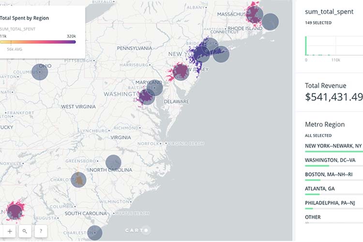
Understanding the productivity of your sales regions, deciding where to focus on service improvement or working out which of your shops is covering too much ground on their own is easy when you see it as a picture.
Maps help you establish relationships in your data that you would only see when presented as a picture. Like graphs and table, they are a new way to see your data and bring incredible levels of context and depth of understanding.
If your company has a CRM or ERP system (like Salesforce, Oracle, SAP etc.), the chances are that you already have a lot of data on your customers, on orders, marketing and new prospective territories. Normally organised into companies and contacts, your accounting system or CRM is already helping you keep your data complete and in order.
If you’ve got one of these company-wide database systems in place, you’ve cleared one of the major hurdles when trying to perform spatial analysis: gathering the data.
Cloud insights
Cloud-based tools like Carto can easily be used to gain insight from your company data: the easy to use web GIS is suitable for anyone with data that has a location component like a street address or IP address.
Ready-made connectors between services like MailChimp, Salesforce, ArcGIS Server and more make it easy to integrate the technology and see instantly where your team is having an impact.
Adding other data to a Carto map like statistics data from a Census is easy and adds context that you would not normally have been able to see when it was in the CRM.
Typical use cases for Carto with CRM/ERP data
Advertising impact – visualising the impact of online or geographically targeted advertising is easy when you use a map. Easily track investment in an area from a campaign and see how many leads and conversions you had from new and existing clients. Instant ROI calculations and reports are simple to make for management.
Sales trip planning – Going to see a client face to face in a far-away place? By segmenting and plotting your customers on a map, you can see nearby clients to contact for your sales trip to get the most out of the time away from home.
Hotspot analysis – Knowing where your sales are coming from can help you understand why they are coming to you and how you can influence people to become repeat customers. Say you were organising three events to target your online customers, but don’t know where to host them. With a map, the solution is easy – simply plot and cluster customer locations into three and find the centroid as a suggestion for places that are easy for everyone to reach. Weight the centroids and clusters based on the most important metrics like new customers or sales frequency or size.
Understanding sales effectiveness – Is salesperson X really good at what they do compared to salesperson Y or are they simply in a very fertile patch? Mapping the territories of a salesperson and comparing that to the potential of an area is powerful. Include data like population, average incomes, number of houses and more to find out where to put more people on.
Let us help you
NGIS can help you set up your database to make it easy to map it with tools like Carto. As well as being partners of Carto for licensing, we also build custom solutions for clients and train them on how to use the software.
Have a look at our Carto page to find out more or get in touch.
Related Articles
Here are more related articles you may be interested in.


