ArcGIS Pro Intermediate
LENGTH: 2 Days
COST: $1,809.50 + GST
TIME: 9:00 AM - 5:00 PM
COST: $1,809.50 + GST
TIME: 9:00 AM - 5:00 PM
LOCATION: Accessible virtually nationwide in Australia,

In-person sessions at select locations

Please note other than the dates below NGIS is able to offer private group training sessions for a team of four or more. Please send an email to training@ngis.com.au and we will do our best to accommodate you.

course information
The ArcGIS Pro Intermediate course is tailored for individuals seeking to elevate their expertise beyond the basics of ArcGIS Pro. Whether you are a GIS professional, analyst, technician, or anyone involved in geospatial data analysis and visualisation, this course offers valuable insights.
Designed as a comprehensive two-day training program, it builds upon the foundational knowledge acquired in the previous course. The focus is specifically on advanced data management, querying, editing, geoprocessing, and analysis workflows. Participants will also explore map production techniques, 3D data visualisation, and data sharing capabilities within ArcGIS Pro.
By delving deeper into the software's advanced features and functionalities, attendees can sharpen their proficiency in handling complex geospatial analysis tasks. The course empowers learners to harness the full potential of ArcGIS Pro and its seamless integration with the broader ArcGIS Platform, including ArcGIS Online, databases, and ArcGIS field maps.
This hands-on training equips participants with practical skills and knowledge to effectively connect, analyse, and visualise geospatial data. Whether you aspire to enhance decision-making processes, create dynamic maps, or collaborate with teams through data sharing, this course serves as a stepping stone towards achieving your geospatial goals.
Previously attended the ArcGIS Pro foundations course or are an experienced user.
- Licensing, ArcGIS Portal, Server and Enterprise G
- Geodatabase domains
- Managing data for analysis
- Automating workflows with tasks and ModelBuilder
- Map Series
- Creating online web maps
- Making web maps with Experience Builder
- Esri Mobile App, with ArcGIS Field Maps
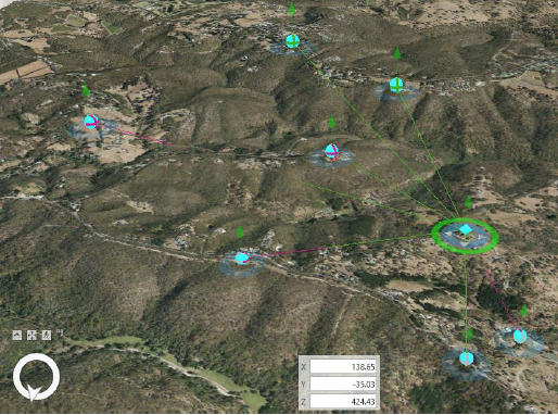
- Working with 3D data
UPCOMING COURSE dates*
| Date | Time | Status |
| 10/04/2024 - 11/04/2024 | 9:00 AM - 5:00 PM |
Closed |
| 05/06/2024 - 06/06/2024 | 9:00 AM - 5:00 PM |
Open please email training@NGIS.com.au to register your interest for the next course
|
*NGIS reserves the right to cancel, postpone or re-schedule courses due to low enrolments or unforeseen circumstances. Where a fee refund is due, such a refund will be provided within 30 days. NGIS will have no further liability.
