Newsroom
Discover more about the impactful work we do globally.
Filter

How mapping saves lives and property in an emergency
Limiting the damage a bushfire or storm event has on a community requires emergency response staff to have quick access to accurate information. They need to know where to focus first and where there have already been the worst effects: burnt out buildings, fire fronts and wind direction. Emergency response is becoming more and more

Using analytics to improve your maps
Free tools like Google Analytics can help you improve your map functionality, ensuring your map credits are used efficiently and give clients the best experience possible for your investment. During the design phase of a project, you have an idea of the functionality your clients will need and try to design accordingly. The design you

Josh wins SSSI National Map Award
We are very proud of our Josh Coniglio for winning the SSSI National Map (Static – Tertiary) award for his bicycle map of Curtin University. Not only did Josh do a wonderful job of crafting a high quality map but he also managed to combine two of NGIS’ passions (cycling and maps) into the one

Does your code enable all Google Maps features?
New features, bug fixes and performance improvements are continually being added to the Google Maps for Work API, but they are only added to the new versions of the code. The question is: why should I use the latest version of the API? Google announces new functionality via their development pages. Some recent improvements include

NGIS wins overall APSEA award
NGIS has won the overall Asia Pacific Spatial Excellence (APSEA) Awards award as well as the category award for the Cyclone Pam Crisis Map, which was built with the CRCSI and Digital Globe. The awards ceremony was part of the Locate16 Conference, APSEA Awards recognised spatial work from 2015. The JK Barrie overall excellence award
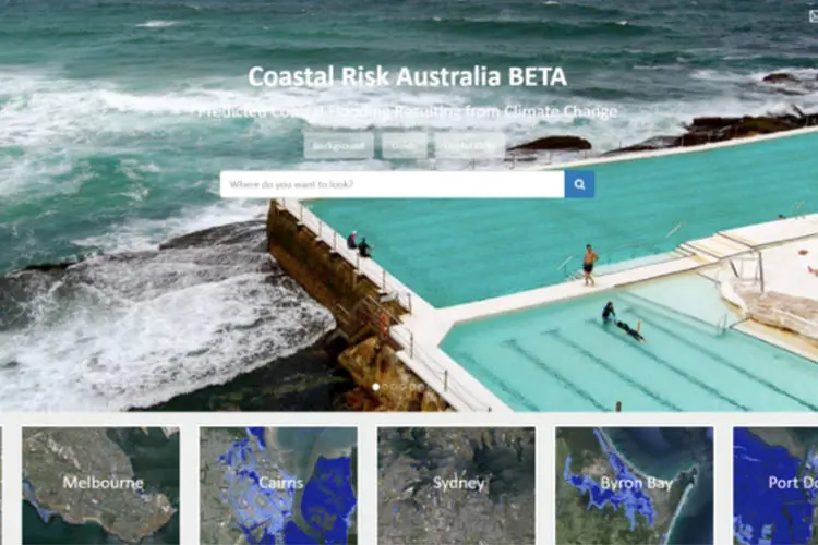
Aussie cities, towns at risk from rising sea levels
World-first website empowers coastal communities to take action For the first time Australians can visualise how their homes, neighbourhoods and favourite coastal spots could be vulnerable to rising sea levels driven by climate change. The Coastal Risk Australia website, made available to the public today, charts the majority of Australia’s enormous coastline and is free

Introducing the GreenPrecision project
GreenPrecision is an innovative website utilising leading edge technology to deliver vegetation analysis across the entire world in an accessible and user friendly tool. By using high performing cloud computing and a massive archive of satellite imagery, users are able to compare vegetation for any location across multiple years to track variability and view changes

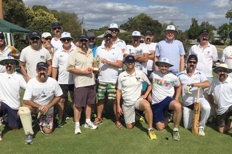
NGIS edge CSBP in cricket friendly
In the Perth Suburbs last Friday afternoon the much anticipated inaugural Foss-McLean Cup was held between NGIS Australia and CSBP. The 20/20 Cricket game was competed in great spirit and entirely underwhelming skills with NGIS managing to chase down the CSBP total of 113 in the 17th over. Great fun and facial hair was enjoyed
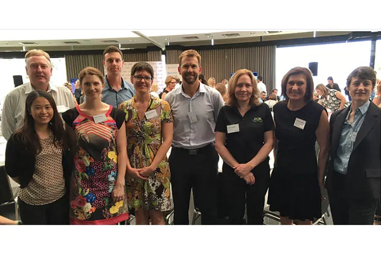
NGIS attends event on attracting women into STEM
On Wednesday March 9, NGIS attended the Attracting Women Into STEM event held by the Committee for Economic Development Australia (CEDA) with eight of our team and two clients. STEM (Science, Technology, Engineering and Mathematics) occupations are of particular relevance to us as a growing company in technology services. We found it particularly surprising to hear of the gap relating


