Newsroom
Discover more about the impactful work we do globally.
Filter
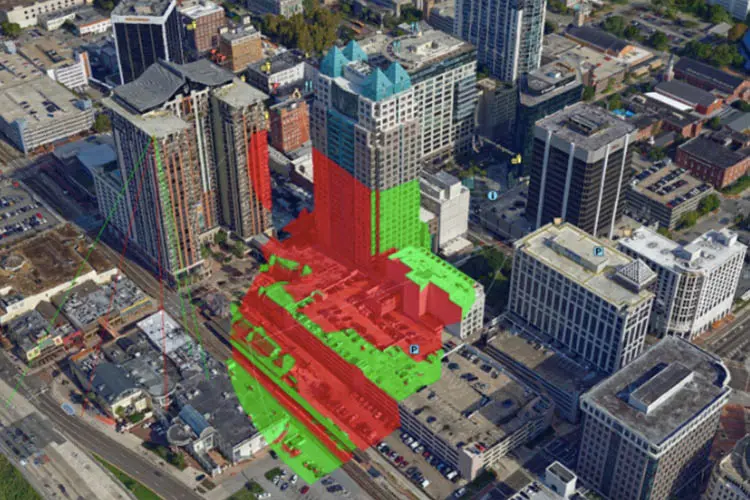
How 3D mapping software can help local councils
3D GIS software Skyline allows councils to evaluate the aesthetic, practical and environmental impact of a proposed project or natural event. This cutting edge technology provides a realistic 3D environment, above and below ground where users can build, edit, navigate, query and analyse data. Skyline provides solutions to local councils’ top problems: shadow analysis and sight calculations,
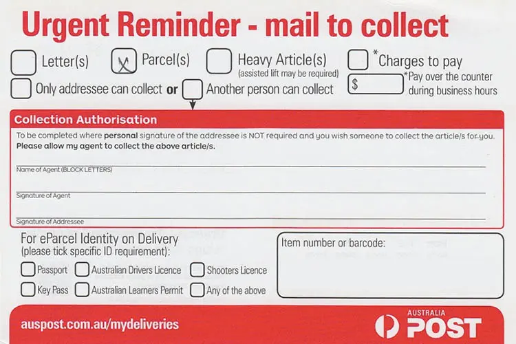
Four challenges in last-mile delivery that still cost businesses money
At the recent Home Delivery Asia Pacific conference in Melbourne around 80 people gathered to discuss the challenge of the notorious “last mile”, the most complex leg of the delivery journey from sender to receiver. Challenges around the exact location of customers – in various places in the world where standard addressing conventions might not

Aussies help neighbours most at risk from rising seas
For the first time, Pacific Islanders living in Vanuatu can visualise how their homes, neighbourhoods – and even popular Australian tourist spots – will be inundated by rising sea levels driven by climate change. The Coastal Risk Vanuatu website, created in Australia and launched globally today, charts low-lying coastline of a number of Vanuatu islands
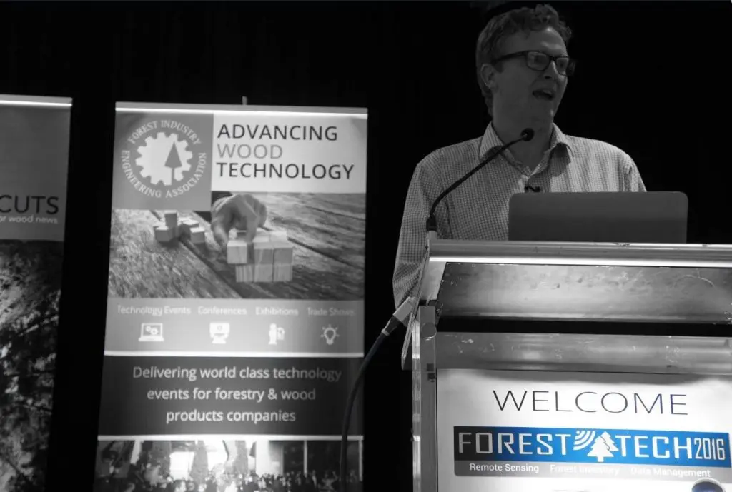
Data-driven approach helping with forestry management
Remote sensing and the increasing use of UAVs are making the management of forestry more accurate than it has ever been. Rapid progress in data capture sensors and techniques in forestry means a massive expansion in the data available to the industry. The opportunity currently presented to the forestry industry is to make this data
Staff culture — how it has unlocked our success
At after work drinks recently we were enjoying the sunshine and the view of the Perth skyline over the Swan river, when a group of women entrepreneurs came and asked to share our table. Naturally we started networking and one lady said to me she was completely blown away by the passion as I spoke
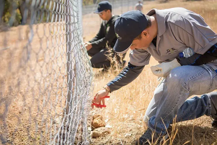
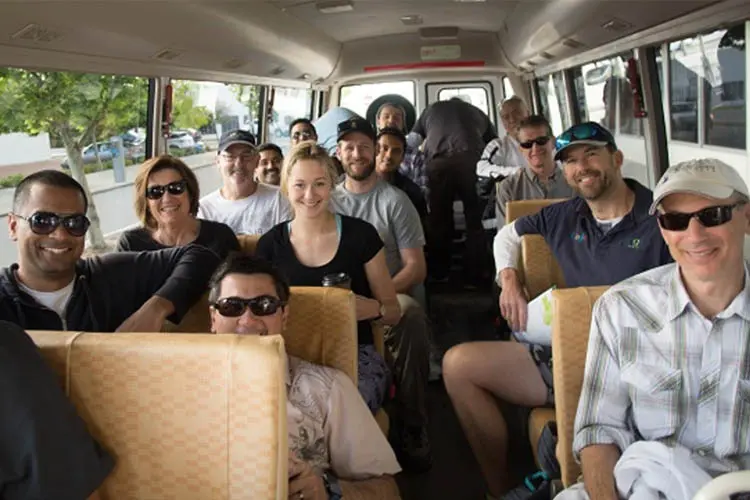
NGIS volunteering day 2016 a success
NGIS has completed another successful annual volunteer day, this year at the Paruna Wildlife Sanctuary: 19 hectares of pristine bushland in the Avon Valley and Walyunga National Park region. The company flew members of the team from New South Wales and Victoria to Perth and took time out of the office to help preserve native
Introducing Google Maps Gold Support
Google Maps Gold support is a higher level of support particularly useful for clients who need peace of mind. You have applications which rely on Google Maps and want to be able to contact Google support at any time, including the weekends. Let’s review the difference between Silver and Gold. If you are on a premium

Why NGIS have an annual volunteering day
Each year NGIS take our entire company out of the office to give back to the community in a volunteering day. In previous years we have donated staff time to Parkerville Children and Youth Care, which was a valuable exercise for a worthy cause. This year, on November 11, we are working with the Paruna Wildlife
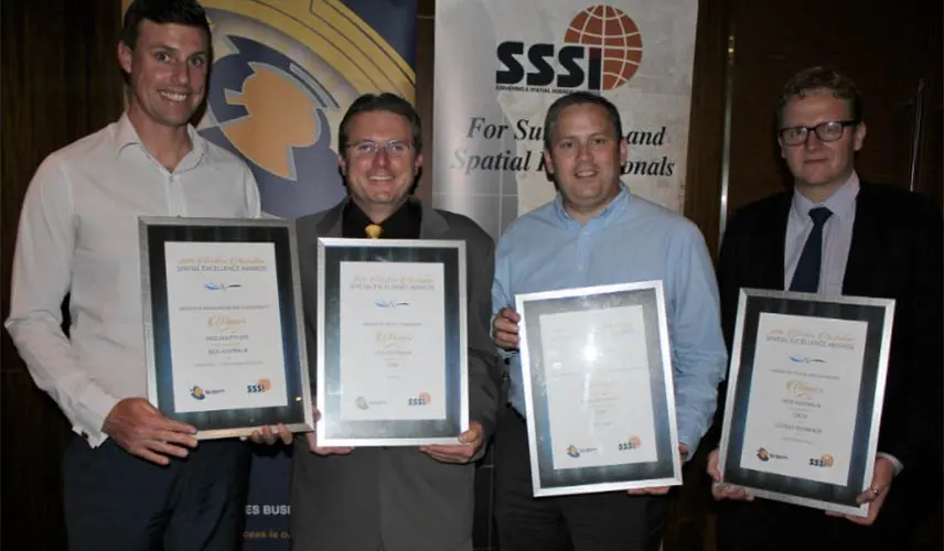
NGIS win four Spatial Excellence awards
On Friday night NGIS were awarded in four categories at the 2016 Western Australian Spatial Excellence Awards, which celebrates the use of spatial information in the industry. The awards came for projects that NGIS has worked on over the last year. NGIS Managing Director Paul Farrell said the awards were a reflection of the dedication the
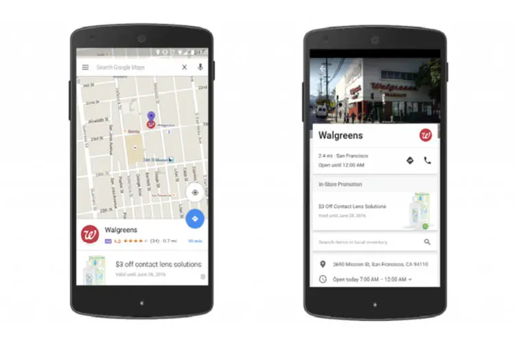
How are ads and maps becoming more integrated? And how can you take advantage?
Google have new integrations of AdWords and Analytics into Google Maps. These changes will affect how businesses use Maps to reach consumers and in turn, how and where consumers choose to shop, eat and more. The new Google Maps ads are designed to help businesses be more visible at moments when consumers are searching online


