Newsroom
Discover more about the impactful work we do globally.
Filter
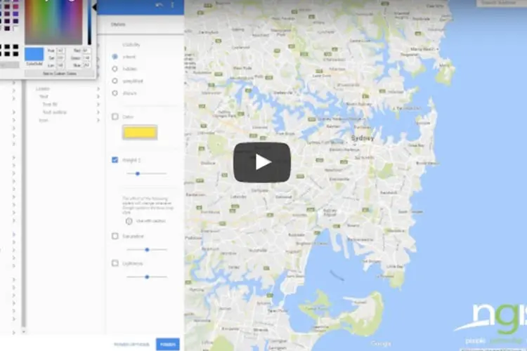
Style your Google Maps to fit your brand and purpose
In this video we highlight the new styling tools and features that Google Maps has to offer. Google Maps styling wizard enables simple and visual methods of creating and styling, to allow business’ to design their maps to be consistent with their brand. Customising and styling every aspect of your Google Maps is possible using

Location technology gives public transport commuters a personalised experience
Location technology is revolutionising the public transport industry by giving commuters real-time, personalised journey information, direct to their smartphones. It’s a customer service innovation that gives forward thinking transport companies and local governments the opportunity to increase patronage, improve goodwill and reduce customer dissatisfaction. Commuters have long been at the mercy of public transport failures.
Building a Google Maps business app? 5 things to ask your developer
Huge business gains can be made by building Google Maps for Work API into your process or product, but to avoid issues down the road, including billing and compliance violations, there are a few questions you should ask your developers during the design and build phases. Maps can help you with team management, customer service,

In Pictures: Strong rainfall supports record crop yield in 2016
Strong rainfall this winter has led industry groups to predict a 16 percent increase in crop yields across Western Australia. The difference is visible on satellite imagery that measures the Normalised Digitised Vegetation Index, or NDVI, which is an indicator of biomass. According to the rural news service The Weekly Times, the Grain Industry Association
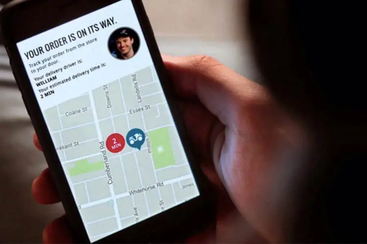
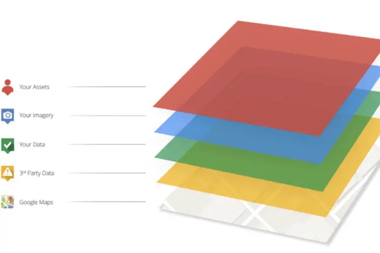
Maps: essential technology for good customer service
In a world where Uber, Domino’s Live Pizza Tracker and Pokemon Go are household names, consumers see maps and location-intelligence as the new norm. Mapping technology has raised the bar for consumer experience. Your customers expect to find directions, track deliveries and pinpoint locations using their smart phones and it’s up to you to accommodate
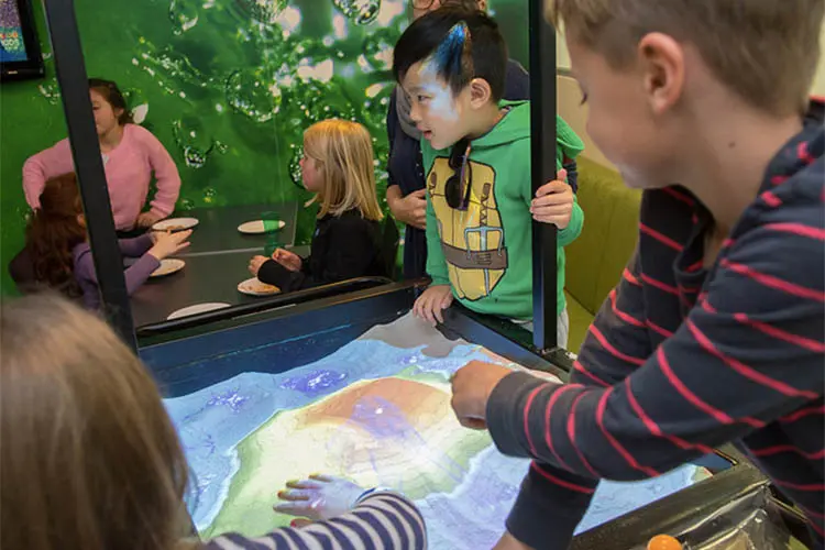
Kids take over NGIS office
NGIS parents brought their kids to work on July 13 so they could learn about where they work and pick up some knowledge about mapping. Bring Your Kids to Work Day is an internationally recognised initiative where children have an opportunity to spend time in their parent’s workplace to learn about the environment and gain some understanding of

Whether you like it or not, you compete with Uber
You might think you don’t compete against Uber. The reality is you do. We live in a world where we all need to continuously become more efficient. Doing the same or more with less resources is the reality we all live with and the challenge is to make your service as valuable and attractive as
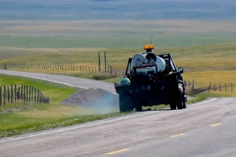
Four ways mapping chemical spray helps councils and business
For companies and council departments in charge of chemical spraying, including pesticides and weed killers, spray logging and mapping is fast becoming an indispensable business tool. The arduous task of keeping track of what chemicals have been sprayed where, when and in what quantities is made easy with spatial tools. That’s because the location of
How does asset tracking make your business more efficient?
If your company is dependent on a mobile workforce, you no doubt already use some form of a GPS for navigation, but did you know you can get more from it than just directions? By enhancing maps with real-time asset tracking, businesses can achieve greater operational efficiency. When vehicles and drivers are operating smoothly, businesses suffer

Mapping your next step
I was recently fortunate enough to travel to the US, where I was able to immerse myself into the ESRI US culture for a full 2.5 days culminating in a Business Partner showcase where I saw some cutting edge technology businesses taking the spatial paradigm to a new level, somewhere far from the reach of


