Newsroom
Discover more about the impactful work we do globally.
Filter

NGIS and Skyline Expand Strategic Partnership Globally to Advance 3D Geospatial Intelligence
Media Release | 27th August 2026 NGIS and Skyline Software Systems are pleased to announce the global expansion of their strategic partnership, building on a successful collaboration previously focused on the Australian market. This next phase of the partnership aligns with NGIS joining the CLS Group, a global leader in Earth observation and environmental intelligence…

From Pixels to Predictions – The New Era of Earth Observation
The new era of Earth Observation using high-frequency satellite data. Today, Earth observation (EO) moves beyond capturing images of the planet. It is about understanding change to deliver insights needed for better decisions. This shift is transforming how governments and organisations understand environmental change, infrastructure development, climate risk, and natural resource management. Instead of relying…

How Satellite based Earth Observation Supports Emergency Response Teams
Natural disasters are an increasingly familiar reality, yet their unpredictability remains a core challenge. This is why preparedness is our best means of mitigating impact when disaster does occur. Satellite technology plays a critical role in enabling this readiness, but why? To understand this, you need only consider the sheer scale and diversity of Australia’s landscapes, waters and ecosystems. The continent spans 7.7 million square kilometres and, relative to its total area, has a low population density. This…

United Nations, Google Cloud and NGIS Team Up to Bring AI-Powered Planning to Communities in Crisis
The United Nations International Organization for Migration (IOM), in partnership with Google Cloud and NGIS are advancing data-driven humanitarian planning through the use of AI and Geospatial powered tools, helping humanitarian organisations to analyse the most vulnerable locations across multiple areas and proactively plan for disaster response, climate driven displacement, and long term community recovery. At the centre of the initiative is the…

Celebrating Women in GIS: More than Maps
From tracking deforestation to building geospatial tools from the ground up, the women at NGIS are driving impactful real-world outcomes. This International Women’s Day, we spoke to three women across our Earth Observation, software engineering and spatial analysis solutions, to find out what first attracted them to GIS, what keeps them here, and what they’d tell their younger selves starting out.

NGIS joins global space-based solutions provider CLS
Media Release | 27th January 2026 NGIS is excited to announce that the company will now be part of CLS (Collecte Localisation Satellites), a global leader in monitoring and surveillance solutions for our Earth. The acquisition marks a significant milestone for the Australian geospatial sector, bringing together NGIS’ world-class geospatial expertise with CLS Group’s expansive reach and innovative capabilities in space-based solutions. Beyond technology and commercial…

The view from the Cuipo Tree: Rethinking Biodiversity Beyond Protected Areas
Biodiversity Biodiversity is often discussed in abstract terms, percentages protected, species at risk, and hectares conserved. Ecological networks operated at vast and local spatial scales. It lives at the intersection of forests and farms, rivers and roads, protected areas and working landscapes. Geospatial intelligence allows us to see these intersections clearly: to understand where species…

The Future of Geospatial: Key Trends for 2026
The geospatial sector has evolved and rapidly grown over the past decade, and in 2026, its role within organisations is more critical than ever. What was once primarily used for mapping and visualisation has become a powerful intelligence tool, connecting data, places, and decision-making across industries. As organisations face increasing pressure to operate sustainably, manage…

Streamlining ArcGIS License Management with Automation
The increasing complexity of ArcGIS licensing in recent versions has created challenges for organisations managing larger numbers of users with diverse needs. The legacy license manager for ArcMap and earlier versions of ArcGIS Pro, along with a small number of user types and roles, have now been superseded. ArcGIS Pro licensing has now been consolidated into ArcGIS Enterprise and aligned with user types, which themselves have more fine-grained licensing options. Overlaying this evolving licensing…
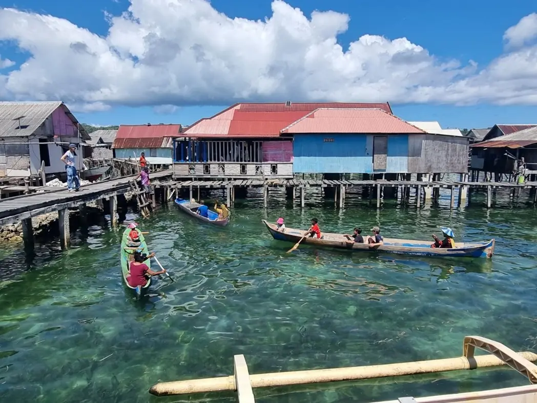
Teaching Conservation at the Heart of the Coral Triangle
This past summer, I returned to a remote corner of Indonesia, the Wakatobi Marine National Park. The National Park sits at the epicentre of the Coral Triangle, home to the highest marine biodiversity on Earth. However, this time, I wasn’t there as a researcher or on holiday. Instead, I was teaching the next generation of…