Emergency Services

Discover more about the impactful work we do globally.

    How Satellite based Earth Observation Supports Emergency Response Teams

    How Satellite based Earth Observation Supports Emergency Response Teams

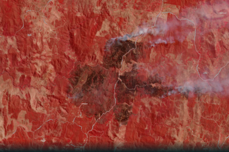
    Natural disasters are an increasingly familiar reality, yet their unpredictability remains a core challenge. This is why preparedness is our best means of mitigating impact when disaster does occur. Satellite technology plays a critical role in enabling this readiness, but why? To understand this, you need only consider the sheer scale and diversity of Australia’s landscapes, waters and ecosystems. The continent spans 7.7 million square kilometres and, relative to its total area, has a low population density. This

    Read article

    How Fire and Emergency Services are accessing satellite imagery acquired Australia-wide everyday, to prepare for and mitigate the impacts of the Bushfire Season

    How Fire and Emergency Services are accessing satellite imagery acquired Australia-wide everyday, to prepare for and mitigate the impacts of the Bushfire Season

    “It’s the biggest risk we’ve faced since the 2019-20 fire season,” New South Wales Rural Fire Service Commissioner, Rob Rogers – Sky News, September 2023. With the Bureau of Meteorology declaring in September that Australia was now in an El Niño climate pattern, Eastern parts of Australia are likely to experience an “increased risk” of

    Read article

    How mapping saves lives and property in an emergency

    How mapping saves lives and property in an emergency

    Limiting the damage a bushfire or storm event has on a community requires emergency response staff to have quick access to accurate information. They need to know where to focus first and where there have already been the worst effects: burnt out buildings, fire fronts and wind direction. Emergency response is becoming more and more

    Read article