Newsroom
Discover more about the impactful work we do globally.
Filter

Speedy planning and built environment design with LiDAR
Excellent design is a key measure of success for the public sector, especially when it comes to planning within environments that are already fully or partially developed. Examples of this might be a new shopping mall on a main street, installing traffic lights or roundabouts on a busy thoroughfare, or running a tramway down a
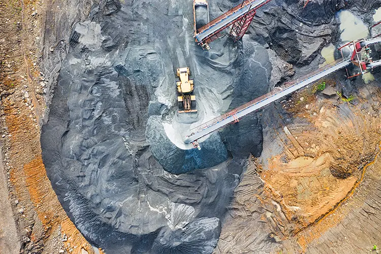
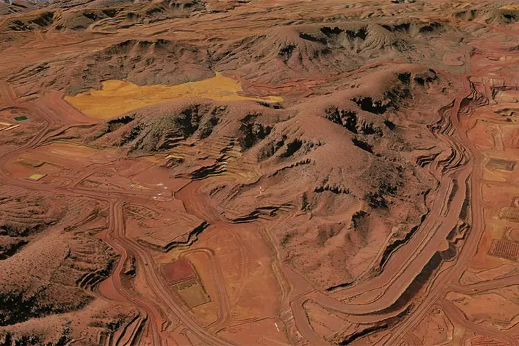
How connected geospatial data is transforming the mining industry
During the lifecycle of a mine, there are large amounts of data being captured across disparate systems. Often, the data that is used to help decision makers operate sites efficiently and sustainably are inherently spatial. Connecting the different geospatial data sources across the mining life cycle enables business units to have valuable situational awareness across
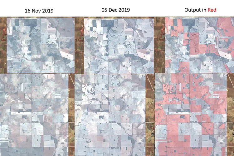
Choosing the right Machine Learning approach for your geospatial project
Machine learning (ML) helps us find patterns in data through the use of algorithms. By using algorithms to build models that uncover connections, organisations can make better decisions faster and without human intervention. From a geospatial perspective, an example of using ML is via image analysis in remote sensing work. But how do you choose

Using Terraform to automate Google Cloud deployments
People love to say things like “let’s move to the cloud”, “get started in minutes” or “just put it into BigQuery”, but developers understand that there is much more to it than that. The journey to move completely to the cloud is one that takes a lot of care and consideration. However, in many cases
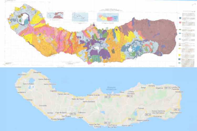
Make static maps digital in a few hours with Machine Learning
Some time ago, I was working on a project that required a map to get some geospatial information on the Lithology (the study of rocks) of the Island of San Miguel in Azores, Portugal. When I asked for the data, to my surprise, I was sent a photocopy of the original geological map in a JPG format.
What’s influencing the spatial industry in 2021?
The spatial industry is relying on, investing in and processing more data than ever before. Businesses are finding new ways to realise the potential of spatial data they’ve collected for years and how they can process this information in new ways to drive their decisions. Last year, we saw organisations adapt to remote working, invest

No phone reception? No problem with ArcGIS Field Maps
Have you ever been navigating somewhere with Google or Apple Maps when all of a sudden your base map stops updating? Then you look at your phone and realise you are out of mobile reception range? Living in the big state of Western Australia, I’ve had this issue many times. This is where offline capable
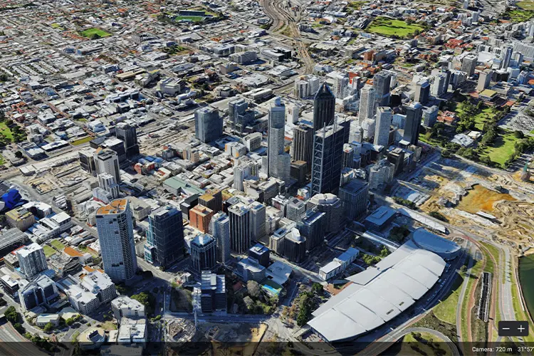
Stacking up 3D GIS heavyweights: Google Earth Enterprise & Skyline
Of the 3D Geospatial Information System (GIS) platforms currently available on the market, Skyline and Google Earth Enterprise (GEE) are usually found at the top of people’s lists. Skyline is a commercially licensed and supported GIS platform, whereas Google Earth Enterprise is an unsupported and open source GIS platform. When it comes to choosing a platform that works with
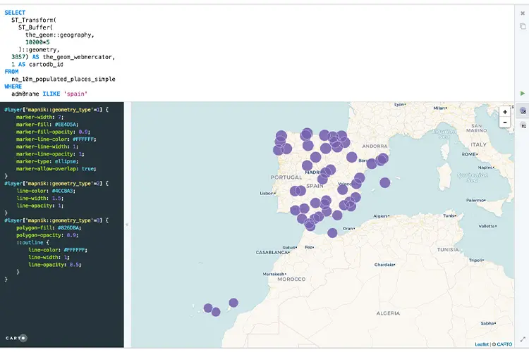
Want to query GIS data in Google Cloud? You need to know Spatial SQL
In one of our most recent Location Matters podcast episodes, BigQuery Product Manager at Google, Chad Jennings and Director of Spatial Data Science, Matt Forrest, both acknowledged that for the up and coming GIS experts, it was a must to learn Spatial Structured Query Language (SQL). But why? As a society, we are ingesting more
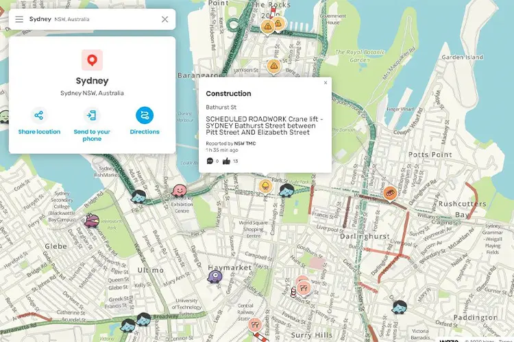
Importing real time roads and traffic data into Waze
Waze is a GPS navigation app owned by Google that combines Google’s road network information with their data feed partners. This information is collected and verified plus provides timely updates to changes on the road from planned road works to broken down cars and speed camera locations. Waze partners can independently communicate road closures and


