Newsroom
Discover more about the impactful work we do globally.
Filter
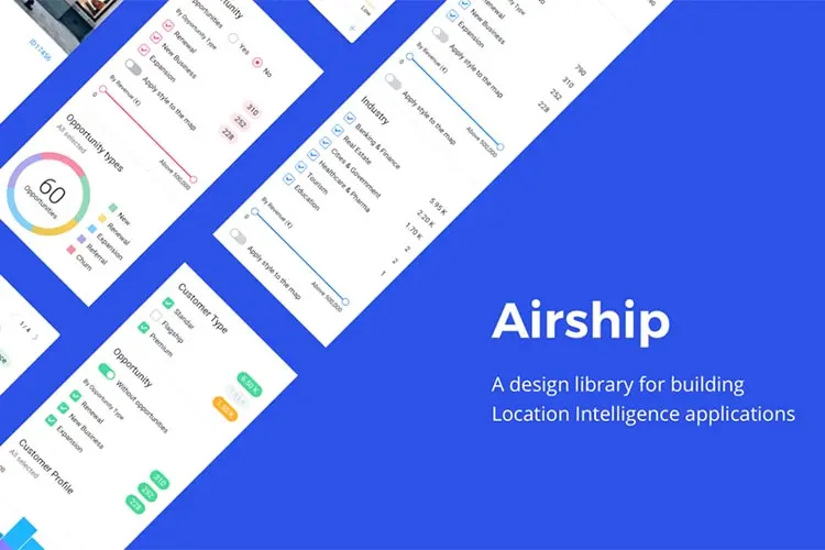
Make apps faster with CARTO’s front-end design library
Location Intelligence platform creators CARTO have announced the launch of Airship, a front end design library for map applications. Airship provides developers with pre-built code snippets to create customisable and beautifully designed user interfaces. It allows for an intuitive experience for both developers and the end users. Airship is one of the tools CARTO released

Data streams: how they are helping businesses make decisions with maps
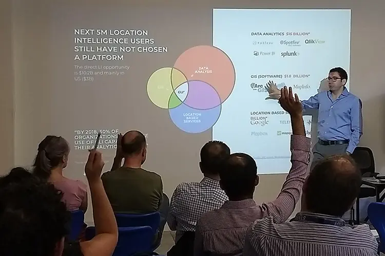
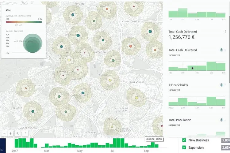
It is now easier to solve the challenges around market analysis, store placement, sales management and other common business problems with the introduction of new data into the CARTO Data Observatory. CARTO’s new data streams products were presented by their head of Asia Pacific Fernando Carrasco at a series of NGIS events around Australia at
Refugee crisis management eased after successful mapathon
Map building volunteers have helped the UNHCR and their partners manage an escalating refugee crisis in Uganda. NGIS sponsored the latest map-a-thon held by the Surveying and Spatial Sciences Institute(SSSI). On April 28, an enthusiastic group of 25 mappers commenced a four hour challenge to digitise buildings and sanitation facilities in Uganda. An escalation in

Don’t pay twice for your Google Maps
If you’re a Premium Plan customer whose licence expires after June 11, 2018 there is a risk you will be paying twice for the same service if your licence key is not correctly implemented in your code. For some customers there will be a period of up to 15 months where the old Google Maps

How to avoid Google Maps Platform bill shock
Under the new Google Maps Platform pricing model there will be various changes to the way you are billed compared to the current Google Maps API Premium Plan. Some applications that previously required a licence will be free going forward, but others that enjoyed a daily bucket of free credits will be more expensive. Knowing

First partner of FrontierSI
NGIS is proud to announce it is the first private organisation to partner with the newly formed FrontierSI. FrontierSI is a research and development centre bringing together government agencies, businesses and educational institutions to provide spatial information. FrontierSI is the successor entity of the Cooperative Research Centre for Spatial Information (CRCSI) and will officially launch

Will your Google Maps application stop working?
The new Google Maps Platform is going to cause many applications that were coded before 2017 to stop functioning as Google tighten its rules about responding to unkeyed requests to the API. Changes to Google Maps are happening between June 11 and August 11, 2018 that will see keyless requests to the APIs start to
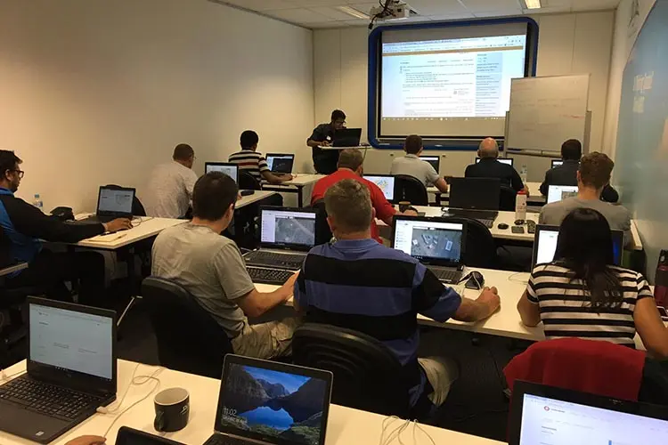
Event series: CARTO data streams
Everyone knows that data is required to make decisions, but sourcing and making sense of it can be challenging. Using a map with constantly updated data can make communicating insights easier and more reliable. In May and June, NGIS is hosting a series of events in Sydney, Melbourne and Perth to show how you can
CARTO Locations conference wrap up
The future of sophisticated and beautiful web maps is looking rosy following the CARTO Locations conference in Madrid. NGIS sent two people – Executive Director Richard Bentley and Product Lead Adam Mullett – to the conference on April 19-20 where Location Intelligence platform creators CARTO showed off their road map and their product updates. The

How the new Google licence model will enable you
Google Maps have restructured how API requests can be purchased, making it simpler than ever before to create custom business solutions using Google Maps. The Google Maps Platform breaks the APIs down into three components: Maps, Routing and Places. These three mapping components make it simpler than ever for developers to control map credit usage.


