Event series: CARTO data streams
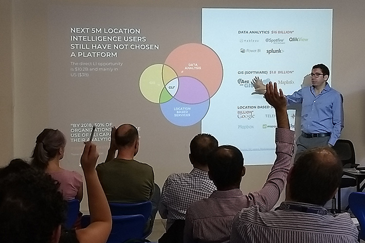
Everyone knows that data is required to make decisions, but sourcing and making sense of it can be challenging. Using a map with constantly updated data can make communicating insights easier and more reliable.

In May and June, NGIS is hosting a series of events in Sydney, Melbourne and Perth to show how you can use newly available data streams with the power of location analytics.

What could you do if you could use a map to easily understand and communicate:

  • Where customers come from before they hit your venue or shop and how long they linger?
  • How people move – the mode, the frequency and the speed?
  • The nature, frequency and origin of credit card transactions in a region of interest?
  • How demographics change each year in your market?

Up to date and pre-processed data is vital to finding insights on how to target customers or improve the user experience of your customers. When you are armed with data that is in the right format and easy to use, your understanding of the world can become deeper. 

At this event mapping consultants NGIS Australia and Location Intelligence platform creators CARTO will show how the world of data is changing and how you can use it to create competitive advantage and communicate better with all stakeholders.

Who should attend:

  • Market research professionals
  • Marketing strategists
  • Data Scientists

Speakers

NGIS Consultant Adam Mullett will talk about how data is changing the way businesses make decisions and why you need to move beyond Census data to make the right decisions for your business or your clients. Adam will show examples of where up to date data has helped governments and businesses make data-driven decisions.

CARTO head of Asia Pacific Fernando Carrasco will show off CARTO’s data observatory and explain how CARTO is changing its product offering to make procuring up to date data really simple.

Dates and links to register:

  1. Sydney – May 31, 2018
  2. Melbourne – June 5, 2018
  3. Perth – June 8, 2018


Related Articles

Here are more related articles you may be interested in.

Empowering the Abu Dhabi Department of Municipalities and Transport in Traffic Monitoring and Flood Mitigation

Posted on
TraceMark™ Flow an NGIS Solution has helped the Abu Dhabi Department of Municipalities and Transport (DMT) in traffic monitoring and flood mitigation. During the heavy rain event in April 2024, TraceMark™ Flow proved instrumental in managing traffic disruptions and infrastructure challenges by providing real-time data and intuitive dashboards for swift, informed decision-making. Beyond traffic monitoring, TraceMark™…
Read More Empowering the Abu Dhabi Department of Municipalities and Transport in Traffic Monitoring and Flood Mitigation

TraceMark takes home the Transformative Solutions Award at The INCITE Awards

Posted on
We are pleased to announce that NGIS has won the Transformative Solutions Award for our TraceMark™ Sustainable Sourcing platform at this year’s INCITE Awards. Earlier this month, our team attended the awards ceremony at The Westin Perth. It was a wonderful evening, and a fantastic opportunity to meet so many West Australian innovators. This award…
Read More TraceMark takes home the Transformative Solutions Award at The INCITE Awards

NGIS shines at Locate24: celebrating success and innovation in geospatial technology

Posted on
Last month, NGIS had the pleasure of being the premium sponsor at Locate24, a premier event packed with highlights and opportunities for the geospatial community. The bustling three-day conference, held at ICC in Sydney, saw over 1000 delegates attend from around Australia and overseas. It was a fantastic platform for connecting with our peers, partners…
Read More NGIS shines at Locate24: celebrating success and innovation in geospatial technology

Unveiling our Inaugural Impact Report: Building a Better Future Together

Posted on
We are thrilled to unveil our first Impact Report, showcasing our commitment to making a positive impact in everything we do. We’re proud to share with you the initiatives we’ve undertaken to solve some of the most pressing global issues. Join us as we celebrate our achievements and highlight impact through geospatial. Key Achievements: Bridging…
Read More Unveiling our Inaugural Impact Report: Building a Better Future Together

Navigating the future: Unlocking the power of immersive 3D realities from Google

Posted on
In a world that is anything but flat, our digital experiences often remain confined to the limitations of a 2D environment. However, the real world is three-dimensional and the potential for innovation lies in bridging the gap between our digital and physical realities.  While 3D data and applications have been around for some time, they…
Read More Navigating the future: Unlocking the power of immersive 3D realities from Google