Seeing the City in a Whole New Dimension

When the City of Canterbury Bankstown set out to improve the way it planned and communicated urban development, it had a clear vision: make the city easier to see, understand and shape for the future.
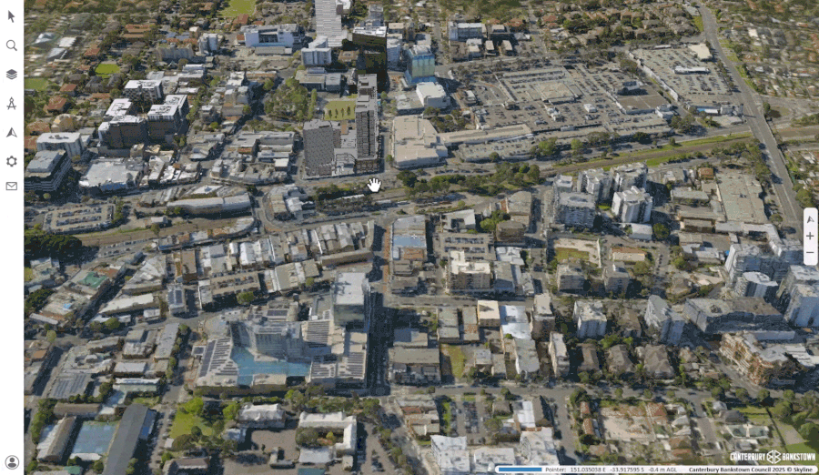
NGIS brought that vision to life by delivering a powerful 3D digital model using the Skyline Enterprise Technology Suite. This living, interactive model allows council staff, residents and developers to explore the city in detail, from its skyline and streetscapes to the shadow a new building might cast.
Why was the Change Needed?
For years, planning decisions were often based on flat maps and static images. While functional, they couldn’t fully capture how a proposed change would look and feel in the real world. The council needed a solution that could:
- Present proposals in a way that was clear and accessible to non-technical audiences.
- Support precise analysis of impacts such as line-of-sight and shadowing.
- Improve collaboration between urban designers, planners, developers and residents.
This called for a dynamic, future-ready platform that could grow with the city’s needs.
From Vision to Reality
Working closely with the council, we approached the project in three stages.
Discovery and Planning
We began by engaging with council staff to define objectives, establish communication channels, and set clear expectations.
Design and Architecture
We created a tailored solution architecture for Canterbury-Bankstown, mapping out development, testing and production environments to ensure the system was robust, secure and sustainable.
Implementation and Training
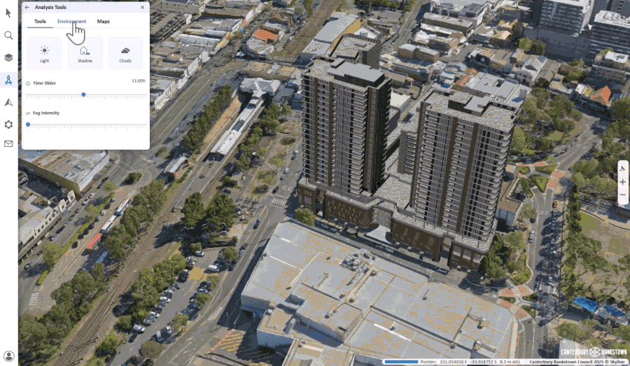
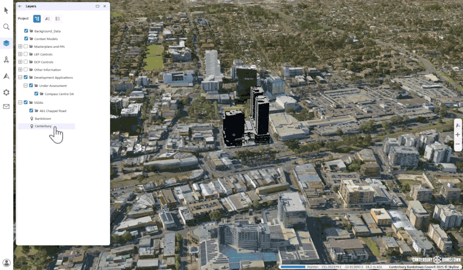
In the final stage, we configured and deployed Skyline Globe, a suite of 3D geospatial tools to visualise, analyse and share data in 3D environments. Our team worked through challenges such as VPN speeds and software performance issues to ensure smooth operation. Once the platform was live, we delivered highly interactive, in-person training sessions with the Urban Design and City Planning Teams. These sessions focused on valuable functions such as shadow and line-of-sight analysis, with strong engagement and participant feedback.
The Outcome
The result is more than just software; it’s a new way of working. Urban planners can now test design ideas in real time, exploring how a new building will fit into the skyline or whether it will block the afternoon sun in a nearby park. Developers can better understand council requirements, and residents can see exactly what’s being proposed in their neighbourhood.
These capabilities improve collaboration, reduce misunderstandings and build trust between all stakeholders.
- Live incident visualisation
- Location-based alerts and notifications
- Decision support in a single, common operating picture
Rather than functioning as a traditional GIS with layers, RTOP enhances the map by creating editable, prioritised notifications where business rules indicate conditions requiring operator intervention.
Looking to the Future
This project also sets the stage for the future. The framework NGIS developed with the City of Canterbury Bankstown is one that can be adapted and rolled out for other councils, making it easier than ever to bring the benefits of 3D visualisation to governments across Australia.
For Canterbury-Bankstown, it means they now have a future-ready platform for smarter, more transparent urban planning. For NGIS, it’s proof of what can be achieved when technical expertise meets strong collaboration.
Interested in bringing the power of 3D visualisation to your city? Contact us to learn how we can deliver a tailored solution for your organisation.


