Improving mapping technology for the University of Auckland
The University of Auckland (UoA) is the largest and highest ranked university in New Zealand. The University continually strives to improve student experiences and consistently places among the top 100 universities in the Quacquarelli Symonds World University Rankings.
The University is a complex venue and can be considered a small city in its own right, covering a massive 99 acres with multiple campuses and over 43,000 students. For students, finding classrooms and places of interests can be a challenge without the right wayfinding technology.
Students are more familiar with google maps
A recent survey revealed that students preferred Google Maps due to its popularity and that it is perceived to be easier to use.
The UoA’s previous mapping solution was unfamiliar to students as it was not based on Google Maps, and was challenging to innovate or enhance quickly. UoA wanted the outdoor map to show bus stops, walking and car distances, so the students will be able to calculate their estimated time of arrival correctly and navigate from anywhere around Auckland to on-campus. Once on-campus, the indoor solution needed to include indoor wayfinding guiding the students and staff to their points of interest.

“With the liveli solution, bringing together google maps and mapsindoors software, students are able to have a familiar, easy to use mapping technology that allows them to easily find buildings, classrooms and places within the campus grounds”
Oliver Tipping, Digital Experience lead at the University of Auckland
A university map that allows on and off campus navigation
Liveli (part of NGIS) is a proud partner of Google Maps and MapsPeople. The UoA selected Liveli to create a map of their university campuses that suited their students’ needs, with an aim to improve the overall awareness and experience of all facilities the University has to offer. Liveli understood that the University needed a highly visual and functional mapping solution that would enable their students to easily and efficiently find places from wherever they were located. This was achieved with the unique combination of world leading Google Maps and MapsIndoors (from MapsPeople) platforms.
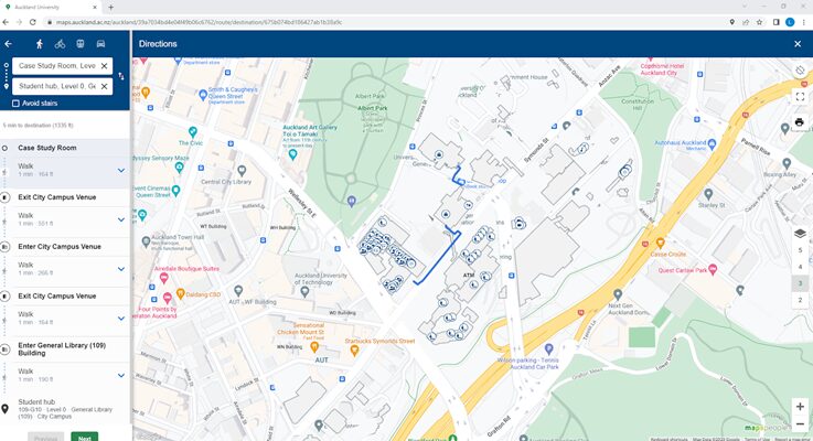
MapsIndoors is built on Google Maps, providing the UoA with a Google Maps view of their buildings, capitalising on user comfort and familiarity with the Google product. Liveli built the University’s new web application mapping solution using MapsIndoors and Google Maps providing a variety of functions, specific to the requirements of students and staff. This includes the ability to search for a room, how long it would take to get there, as well as directions around the campus to classes or essential amenities like bathrooms and water fountains.
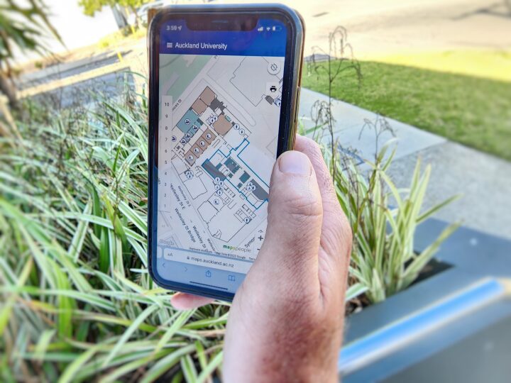
Students are able to look up the closest accommodation, library, food and drink shopping venues, and more with just a click on their phones. The Liveli solution is a highly visual and interactive experience providing users with an exact route, detailing where and how to travel and even the option to avoid stairs. Looking ahead, UoA is aiming to offer more dynamic mapping experiences for staff and students, such as enabling booking of facilities and monitoring sustainability goals of their buildings.


How liveli, google maps and Mapspeople helped
The Liveli solution allows users to search for specific buildings, rooms and places on campus and then provides additional information related to that venue. The University manages all the content themselves and can alter conditions in real-time, keeping abreast of events at the University.
The solution provides a platform for growth for the University, with a range of integrations for booking rooms, parking spaces, monitoring space utilisation and linking IoT devices for observing energy consumption, temperature and air quality throughout the campuses.
The advanced new solution was necessary for a University of this stature and has raised the profile of the institution while improving accessibility, efficiency and productivity for all its users.

