Make apps faster with CARTO’s front-end design library

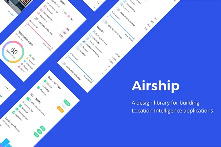
Location Intelligence platform creators CARTO have announced the launch of Airship, a front end design library for map applications.
Airship provides developers with pre-built code snippets to create customisable and beautifully designed user interfaces. It allows for an intuitive experience for both developers and the end users.
Airship is one of the tools CARTO released (alongside CARTO.js 4.0 and Developer Centre) at the CARTO Locations Madrid 2018 Conference.
Airship has a range of independent and reusable components that can be combined into advanced components. These components include:
Donut Chart:
Visualise a breakdown of categories and values.

Gauge Chart:
Visualise percentages with a customisable colour palette.

Buttons and switches:
Add a range of different buttons and switches into your LI application.

Selectors:
Turn layers of data on and off for simple filtering and powerful analysis.

Histogram & Stacked Bar Chart:
Adjustable colours and configuration of data in the form of a histogram or stacked bar chart. This also includes a hover over function to show only selected values.

Flags, Legends, Pop Ups & more:
Several other components have been added to display important information simply and beautifully.

To see how CARTO can help your business, get in touch with our CARTO technology partner, Liveli.
Related Articles
Here are more related articles you may be interested in.
Planet on the Road Bali
Recently, NGIS joined Planet in Bali, Indonesia, for Planet on the Road, the Annual Partner Conference, to learn about their vision for tackling the World’s most complex environmental sustainability governance challenges using the latest advances in digital technology and the rapid innovations in satellite and aerospace capabilities. Charlie Candy, Chief Revenue Officer, and Robbie Schingler,…Geo for Good New York 2025
Imagine you could harness the power of planetary-scale data to solve some of the world’s most pressing environmental problems? That’s the core mission of Geo 4 Good, a conference that attracts geospatial scientists, engineers, and conservationists.Why Planet isn’t your old-school Earth observation provider
When most people think of Earth Observation (EO), they think of complex systems, long lead times, and imagery that’s already out of date by the time it’s delivered. Historically, satellite data has been the domain of specialists, slow to access, expensive to use, and challenging to scale. Planet takes a different approach. Built for speed, accessibility, and insight, Planet provides a fundamentally more agile Earth Observation capability. It’s designed to meet the needs of decision-makers, analysts, and operations teams who don’t just want data; they want answers, quickly.Women in GIS at NGIS
The geospatial industry has long been male-dominated, but women are making strides and shaping its future. At NGIS, women make up 43% of our team, demonstrating our commitment to diversity and inclusion. We are proud to celebrate the talented women at NGIS who are pushing boundaries, driving innovation, and inspiring the next generation. Ahead of International Women’s Day, we spoke to four remarkable women in GIS about their journeys, challenges, and advice for those looking to enter the field. Here’s what they had to say: