Geo for Good New York 2025


Imagine you could harness the power of planetary-scale data to solve some of the world’s most pressing environmental problems? That’s the core mission of Geo for Good, a conference that attracts geospatial scientists, engineers, and conservationists.
It’s hosted by the team from Google that brings us Earth Engine and Google Earth. Google Earth is by far the better-known product; who hasn’t zoomed in on their neighbourhood? But for this conference, Google Earth Engine is the real star.
Since the Earth Engine was first introduced to the world at the 2010 UNFCC COP16 in Cancún, Mexico, it has revolutionised the field of Earth Observation by combining these elements:
- Earth Engine Data Catalog is a massive, over 90 petabyte, collection of the world’s publicly available satellite imagery. It simplifies access by downloading and organising this firehose of data, tagging it in time and space, and making it readily accessible for analysis.
- Uniform API’s: The API allows a researcher to write a script in Python or JavaScript to collect, filter and combine these datasets into new insights – limited mainly by imagination.
- Cloud Computing: Scripts run in the cloud and can operate on the images without needing to be downloaded. This saves researchers from needing to download any of the raw data except the results they are interested in.
- Parallel Processing: Farms your scripts out to thousands of Google’s cloud computers in parallel, where each operates on just a portion of the data. The platform can automatically select the window you are currently viewing to apply filters and select a resolution to perform the calculations in close to real time.
Together, these elements created a rapid prototyping environment that has been critical to innovation in Earth sciences. By keeping the platform free for non-commercial research, Google opened the door to thousands of studies across deforestation monitoring, climate research, biodiversity, agriculture, natural hazards, public health, and urban growth.
Alpha Earth Foundations
These innovations are over 15 years old yet still support new research. At Geo for Good 2025, one of the biggest announcements was Alpha Earth Foundations, a deep learning model built by Google Geo and DeepMind.
This model ingests vast amounts of data from the Earth Engine Catalog and learns to recognise complex patterns. It models each point on the globe into 64 distinct vectors. This capability allows it to find similarities and trends with unprecedented accuracy, outperforming all previous methods.
And the best part? It’s easy to use. For example:
- Select some examples of old-growth forests, and the model will instantly map old-growth forests worldwide.
- Highlight mangroves, and it will generate a global mangrove map in seconds.
- Label different sets of locations, and the model will classify the planet accordingly and with unprecedented accuracy.
Alpha Earth makes advanced pattern recognition accessible to anyone, without needing to build a complex training environment. Early research papers are already underway, and it’s poised to become another foundation of the Earth Engine ecosystem.
Deeper Integration with BigQuery
Another major update was deeper integration of BigQuery with Earth Engine. BigQuery is one of the leading tools for managing massive tabular datasets in the cloud, and combining it with Earth Engine opens new possibilities.
Now, users can view Earth Engine map visualisations of query results directly within BigQuery Studio. This bridges the gap between tabular and geospatial data, empowering researchers, analysts, and businesses alike.
What’s New in Google Earth
Google Earth also received significant upgrades. While Earth Engine is designed for creating new maps, Google Earth is primarily a visualisation and storytelling tool. New features announced include:
- Importing maps and datasets directly from Earth Engine or Google Drive (beyond the old KML-only uploads).
- A more intuitive interface, including chat-style interactions.
- A new paid version integrated with Google Cloud, offering access to layers such as elevation, income data, land surface temperature, EV chargers, tree canopy coverage, and rooftop reflectivity


More Than Just Technology
Beyond the product announcements, what brings Geo4Good to life is the people who attend. The conference brings together conservationists, remote sensing experts, environmental scientists, and cloud engineers to share knowledge, spark collaborations, and experiment with new ideas.
On the final day, participants group into teams and spend the day developing new ideas. I joined a team that jammed on creating a tool to find and map potential wildlife corridors that could connect existing protected areas to increase their biodiversity resilience. We used Alpha Earth Foundations to assess promising new corridors and we had a prototype to show within hours, that I got to present on the big screen.
I know of no other setting that brings together such a great collaboration of conservationists, environmental and remote sensing scientists, and cloud engineers.
Learn more about how NGIS harnesses the power of the Google Cloud Platform and Google Maps Platform to deliver scalable, location-intelligent solutions.
Written by: Chris Goodman, Senior Google Cloud Engineer
Related Articles
Here are more related articles you may be interested in.
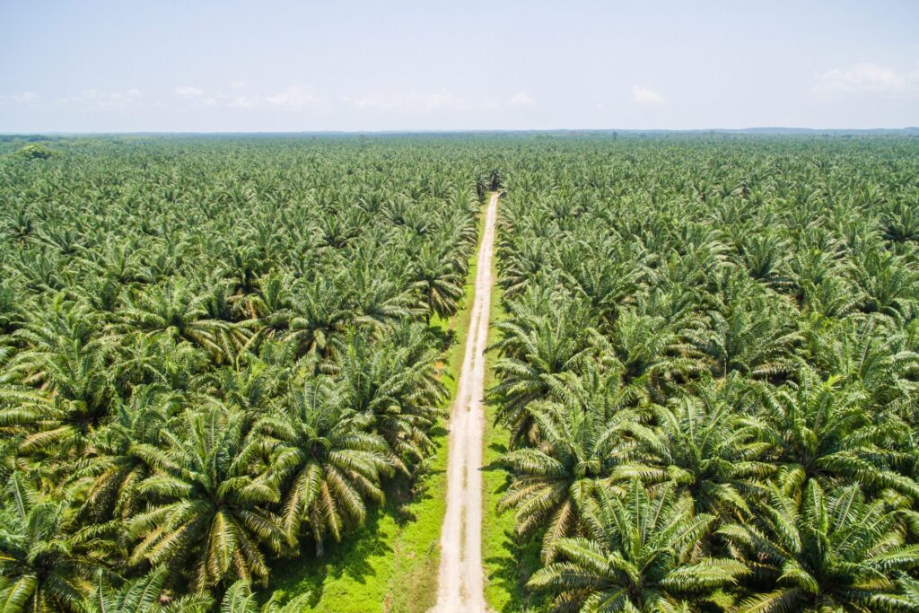
Sustainable Palm Oil
Around 90% of oil palm trees globally are located in Malaysia and Indonesia, islands with the most biodiverse tropical forests in the world. Because palm oil requires up to nine times less land than other vegetable oil crops, its efficient use of land makes palm oil extremely attractive to producers and purchasers across the world.Sustainable Fashion
NGIS and Textile Exchange have continued the investment into the MIE to provide a roadmap for both expanding risk and recommendation content along with addressing new and evolving frameworks and regulations.Protecting Giant Kelp
Giant Kelp has a low tolerance to heat stress. With the warming of our oceans – particularly in the east of Australia where temperatures have risen three times the average global rate, Australia’s kelp forests face significant threat. In eastern Tasmania, a 95% loss of Giant Kelp forests has occurred over the past four to five decades.Eliminating Deforestation
EUDR systems require more than just a list of deforestation alerts. EUDR systems require an enterprise approach to traceability that delivers a robust system of record for EUDR workflows, from transaction level integration with purchasing systems through to direct and automated submission of due diligence statements and numerous workflows in between.