Data streams: how they are helping businesses make decisions with maps
It is now easier to solve the challenges around market analysis, store placement, sales management and other common business problems with the introduction of new data into the CARTO Data Observatory.

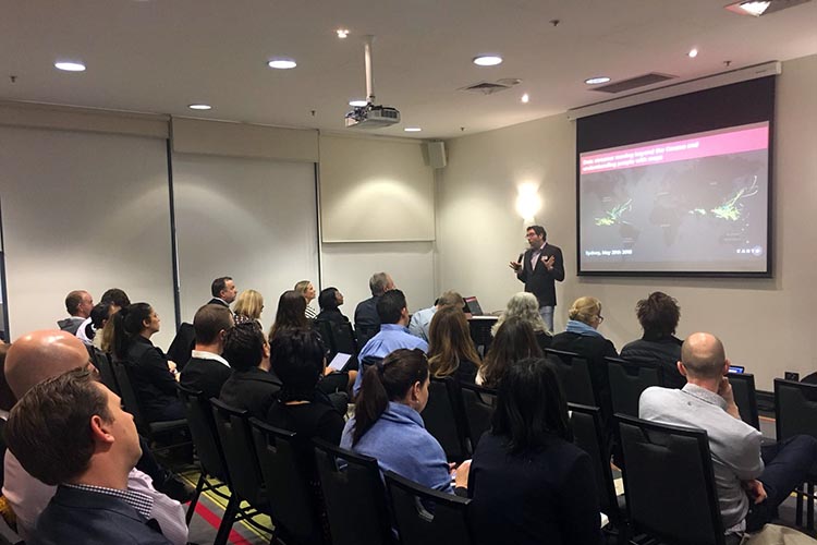
CARTO’s new data streams products were presented by their head of Asia Pacific Fernando Carrasco at a series of NGIS events around Australia at the beginning of June.

Business already know the questions they want answered: where should I place a store? Where do my customers come from? What sort of transactions are happening in this area? How are people moving along certain roads and routes?

The challenge has always been to get relevant data to support decisions. It has been a challenge in the past because data was simply not available, not recent enough, incomplete, had prohibitive privacy restrictions or required too much processing to make sense of it.

Now with the expanded CARTO Data Observatory these barriers to using premium external data sources are removed and you can incorporate them into your other company data for analysis.

New data streams

CARTO has added a range of new premium data sources into the Data Observatory, their marketplace for plug and play data, including Mastercard transaction data, Tom Tom and Waze movement data and Vodafone foot traffic data.

The data is pre-processed to take care of privacy issues and it comes in as a layer in your CARTO map along side any other data you have been analysing.

The ease of use of the data streams are what makes them valuable for business – there is no need to have special contracts in place with data providers or to have to data scientists on staff to manipulate the data into a usable format.

Get the data

The data is available to enterprise users of CARTO who have either a Builder or Engine licence. To find out how you can use it or to receive training on CARTO’s products, get in touch with our CARTO technology partner, Liveli.

Related Articles

Here are more related articles you may be interested in.

Launching a Sustainable Coffee Future

Posted on
During Climate Week 2024, a groundbreaking initiative was announced, uniting key global players to transform the coffee supply chain. The UNIDO Solutions Platform is a digital tool that helps coffee producers gain important insights into their supply chains. By using artificial intelligence (AI), the platform enables producers to understand the environmental impacts of their operations and adopt more sustainable practices. It specifically addresses the new and evolving regulatory requirements, providing data-driven solutions to create a sustainable and climate-resilient coffee supply chain for everyone involved.
Read More Launching a Sustainable Coffee Future

Empowering the Abu Dhabi Department of Municipalities and Transport in Traffic Monitoring and Flood Mitigation

Posted on
TraceMarkâ„¢ Flow an NGIS Solution has helped the Abu Dhabi Department of Municipalities and Transport (DMT) in traffic monitoring and flood mitigation. During the heavy rain event in April 2024, TraceMarkâ„¢ Flow proved instrumental in managing traffic disruptions and infrastructure challenges by providing real-time data and intuitive dashboards for swift, informed decision-making. Beyond traffic monitoring, TraceMarkâ„¢…
Read More Empowering the Abu Dhabi Department of Municipalities and Transport in Traffic Monitoring and Flood Mitigation

TraceMark takes home the Transformative Solutions Award at The INCITE Awards

Posted on
We are pleased to announce that NGIS has won the Transformative Solutions Award for our TraceMarkâ„¢ Sustainable Sourcing platform at this year’s INCITE Awards. Earlier this month, our team attended the awards ceremony at The Westin Perth. It was a wonderful evening, and a fantastic opportunity to meet so many West Australian innovators. This award…
Read More TraceMark takes home the Transformative Solutions Award at The INCITE Awards

NGIS shines at Locate24: celebrating success and innovation in geospatial technology

Posted on
Last month, NGIS had the pleasure of being the premium sponsor at Locate24, a premier event packed with highlights and opportunities for the geospatial community. The bustling three-day conference, held at ICC in Sydney, saw over 1000 delegates attend from around Australia and overseas. It was a fantastic platform for connecting with our peers, partners…
Read More NGIS shines at Locate24: celebrating success and innovation in geospatial technology

Unveiling our Inaugural Impact Report: Building a Better Future Together

Posted on
We are thrilled to unveil our first Impact Report, showcasing our commitment to making a positive impact in everything we do. We’re proud to share with you the initiatives we’ve undertaken to solve some of the most pressing global issues. Join us as we celebrate our achievements and highlight impact through geospatial. Key Achievements: Bridging…
Read More Unveiling our Inaugural Impact Report: Building a Better Future Together