Newsroom
Discover more about the impactful work we do globally.
Filter
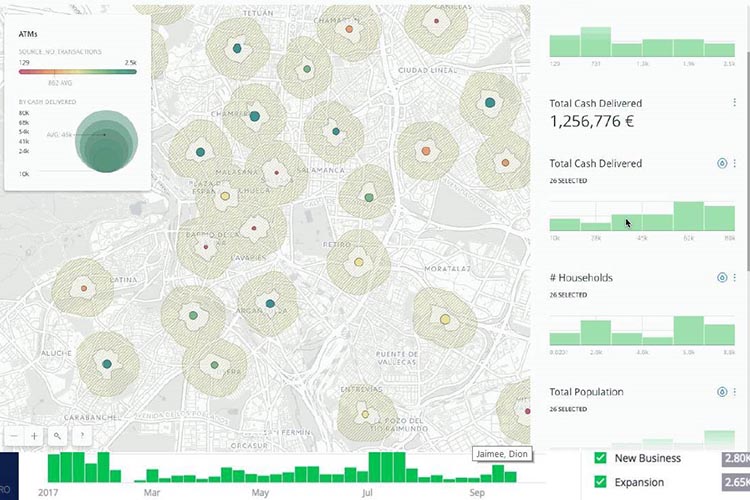
CARTO Locations conference wrap up
The future of sophisticated and beautiful web maps is looking rosy following the CARTO Locations conference in Madrid. NGIS sent two people – Executive Director Richard Bentley and Product Lead Adam Mullett – to the conference on April 19-20 where Location Intelligence platform creators CARTO showed off their road map and their product updates. The

How the new Google licence model will enable you
Google Maps have restructured how API requests can be purchased, making it simpler than ever before to create custom business solutions using Google Maps. The Google Maps Platform breaks the APIs down into three components: Maps, Routing and Places. These three mapping components make it simpler than ever for developers to control map credit usage.
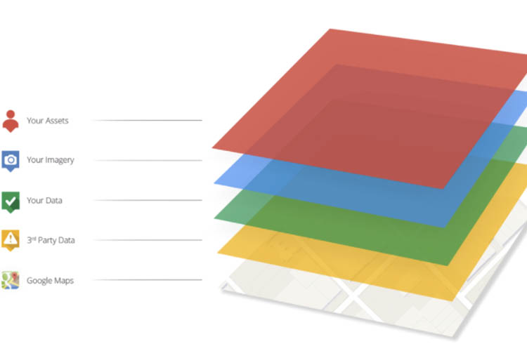
How the Google Maps Platform will be structured
Google Maps API has rebranded as the Google Maps Platform. The platform now aligns with Google’s Cloud Platform in the billing and application console structure. As part of their rebranding, Google Maps Platform have regrouped the APIs under three parts: Maps, Routing and Places. In the past, APIs were referred to individually or as part

Automatic discounting on Google Maps Platform Premium Plan
A new discounting system is being introduced to Google Maps this year that will make it easier to get started with projects and scale them up. Under the previous version of the Google Maps API Premium Plan, customers were required to provide what they thought were the right estimates for usage for the coming year
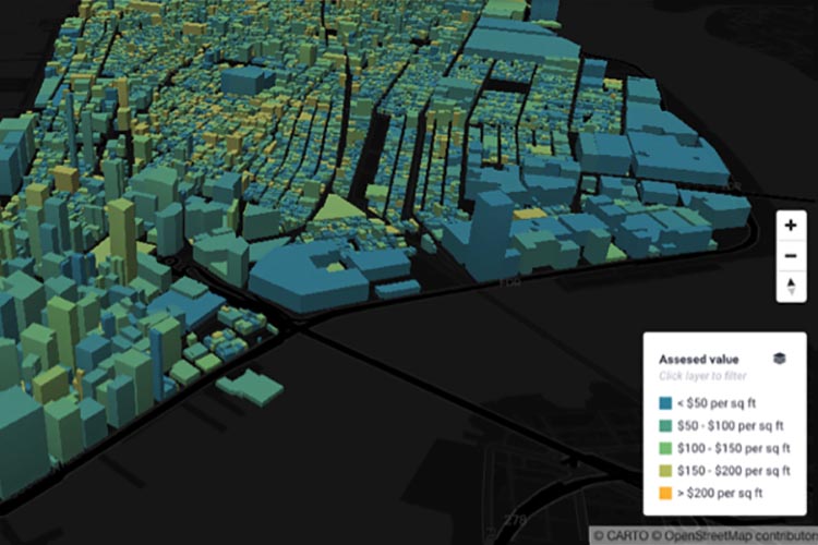
A New Stack for Location Intelligence
Location intelligence leaders CARTO and mapping, navigation and location data providers Mapbox are integrating their services to form a “New Stack for Location Intelligence.” The CARTO platform will now call on Mapbox as the new default provider for location based services, in particular geocoding and routing services. In addition, CARTO now fully supports Mapbox vector

Expectations are sky high: what can you learn from ridesharing giants?
Intuitive user experience and efficient operations have separated ridesharing giants from the rest of the mobile service industry. They are the gold standard for service and they set consumer expectations high. For taxis, it is no longer acceptable to tell someone you’ll be there in 15-30 minutes and for delivered services, telling someone that you’ll

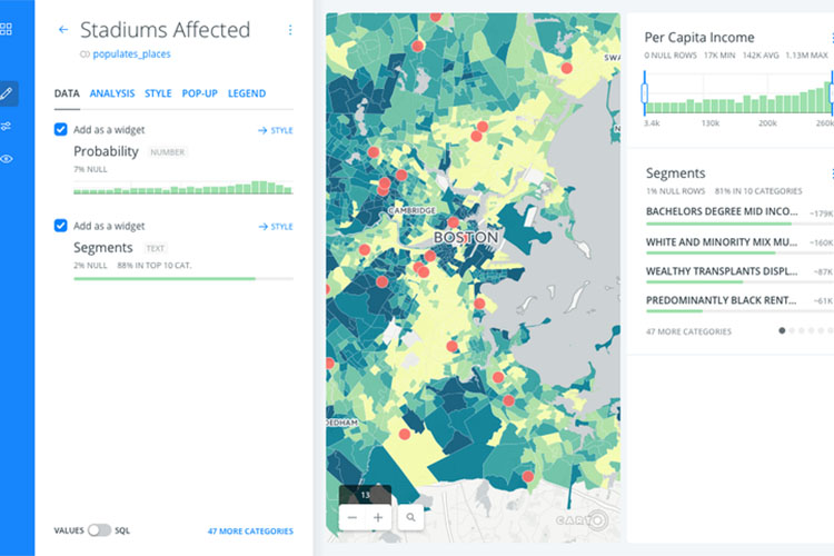
Spatial Technology Explosion: a Pandora’s Box of opportunities and risk
A quick glance at Gartner’s emerging technology hype cycle, the go to chart for any tech consultant in need of guidance, shows that more than half the trends shown rely on spatial technology or could support it. Examples include commercial UAVs (drones), smart robots, smart dust and augmented and virtual reality to name just a
Is it time for you to abandon the PDF map?
Web mapping provides dynamic, up-to-date and relevant spatial information for analysis and decision making that is easy to share. In a data-driven world, businesses are expected to analyse their business insights quickly to make informed decisions. So why is now the time for businesses to step away from the PDF static map towards a more
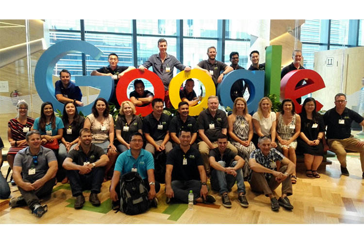
NGIS briefed at Google Singapore
In January, the NGIS staff travelled to Singapore after being invited for a Google office tour and briefing on the evolution of Google Maps API. Three groups of NGIS people were invited to the regional headquarters of the tech giant, which is spread over three buildings and 10 floors. NGIS staff were given guided tours of


