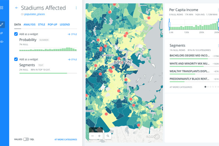
Is it time for you to abandon the PDF map?

Web mapping provides dynamic, up-to-date and relevant spatial information for analysis and decision making that is easy to share.
In a data-driven world, businesses are expected to analyse their business insights quickly to make informed decisions. So why is now the time for businesses to step away from the PDF static map towards a more dynamic and up-to-date webmap?
The answer to this can be broken down into three reasons: interactivity, dynamic information and flexible reading.
Interactivity
Drilling into large data sets can be tedious and time consuming. Web mapping allows users to drill into their data quickly to find the key information. This means users can demonstrate these insights live and draw on different information layers immediately.
The interactive nature of the webmap means information can be viewed or hidden by turning information layers on and off and dynamically filtering the data. Users are able to facilitate their own custom analytics through turning layers on and off based on what they consider to be important.
Showing users only relevant information means they’re likely to find trends and insights easier and more prominently within their data sets. The zoom and pan functions enable viewers to choose whether they want to view information and insights from one specific location or across a vast area, all within the same webmap.
Dynamic information
A dynamic map is good for reporting because its up-to-date with the latest data, which allows users to run weekly or monthly reporting on. This is useful for measuring business processes, such as sales figures or the rollout of a project.
Providing one link to this central, up-to-date data repository means users only need to visit one place to locate all their location information and analyse trends in the data. By comparison, a PDF map only enables one view on the map and a new map must be generated to view new information.
Flexible reading
Creating and tailoring a map as you go that suits your brand and provides only relevant business information is easy with webmapping technology. The web map can be easily shared to different users through a web link and has a responsive design that resizes for desktop, tablets and mobile devices. This allows users to update and access this map anytime, anywhere.
Creating valuable insights from your data and customising the interactive map is available through CARTO.
Where to from here?
Building a web map requires the skills and understanding on an experienced GIS developer. NGIS offers training in a number of technology suites to get you going with web maps that are easy to interrogate and share.
See our training page here.
Related Articles
Here are more related articles you may be interested in.


