CARTO: Cloud-Native Location Intelligence Platform for Spatial Analytics
Analyse, visualise, and develop with spatial data at a limitless scale in your lakehouse.
NGIS is your CARTO partner in Australia and New Zealand
As a CARTO reseller in Australia and New Zealand, NGIS offers comprehensive support with a team of skilled developers and GIS analysts. We provide licensing, application development, and in-house support to integrate CARTO’s powerful functionalities into your business projects
Google Maps Platform comprises 5 streams, Maps, Routes, Places, Environment and Analytics. Each offers powerful tools for maps, places, routes, environment, and mobility. NGIS can integrate static or dynamic maps into your website or application, delivering valuable location context to your users wherever they are
One Location Intelligence platform for all your spatial needs
Streamline your tech stack with an end-to-end geospatial platform built for the enterprise, CARTO has tools for everyone in your team.
Platform Overview
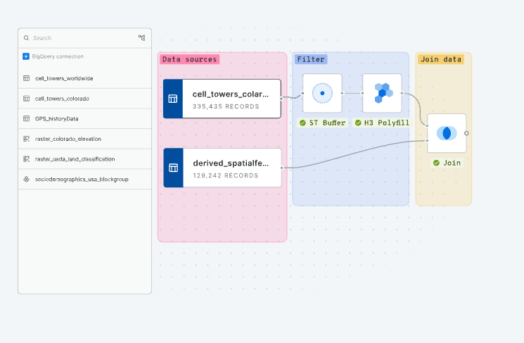
Powerful Spatial Analysis, The Low-Code Way
Leverage over 100 ready-to-go analysis components with native ML and AI integrations built in. Our automated drag-and-drop interface makes complex spatial analysis accessible to everyone, eliminating the need for extensive coding knowledge.
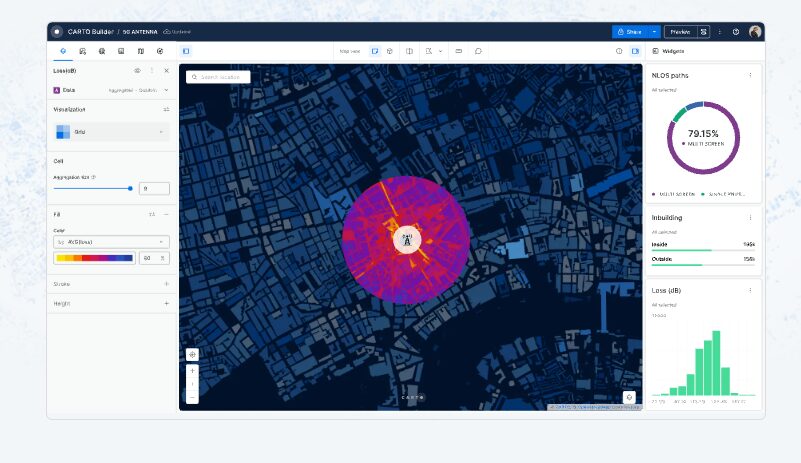
Unmatched data visualisation capabilities
Visualise billions of data points with ease while maintaining performance and clarity. Create interactive maps and dashboards to share insights with stakeholders, all backed by enterprise-scale collaboration tools that keep your teams aligned and productive.
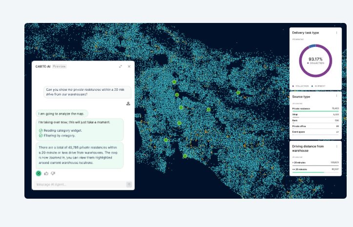
AI Agents for Geospatial Reasoning at Scale
Build custom geospatial agents tailored to your specific business needs and interact with maps and data using natural language. Our model-agnostic platform seamlessly integrates with OpenAI, Gemini, Cortex, and other leading AI providers.
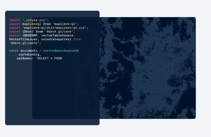
Accelerated, Scalable App Development
Eliminate complex back-end ETLs—your apps run directly in your data lakehouse for maximum efficiency. Enjoy framework-agnostic development with powerful visualization capabilities using deck.gl, WebGL, and GPU-accelerated technology for superior performance at scale.


Spatial Analytics Built for The Cloud
CARTO is the leading cloud-native spatial analytics platform that unlocks powerful location intelligence directly in your data warehouse. From interactive mapping and advanced spatial analysis to drag-and-drop workflows and accelerated app development, CARTO delivers limitless scale without complex ETLs. Access thousands of curated datasets, build custom geospatial applications, and transform location data into actionable insights that reveal not just where things happen, but why they happen there.
Sectors
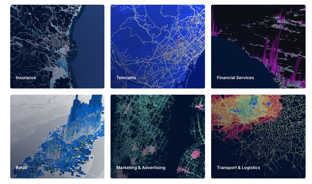
Insurance
Reduce complexity and costs, with a streamlined, cloud-native approach for portfolio risk analysis, catastrophe modeling, and fraud detection—all while maintaining flexibility and scalability.
Telecoms
Anticipate and adapt to network demands at scale to optimize coverage, connectivity, speed, and availability. Leverage spatial intelligence to enhance infrastructure planning.
Financial Services
CARTO’s cloud-native approach delivers the speed, scale, and security you need to break data silos, accelerate insights, and beat the competition. Unlock spatial analytics to drive smarter decisions.
Retail
Spatially focused retail analytics is crucial in an era of omnichannel. If your brand is planning to survive & thrive through tough retail conditions, location Intelligence is the secret weapon.
Marketing & Advertising
Whether you’re planning or measuring the effectiveness of Out of Home Advertising campaigns, using offline data to understand the “real-world” behaviour of consumers is a must.
Transport & logistics
Optimising transport infrastructure spatially is key to the future of mobility. The most efficient cities are moving away from traditional methods to analyze new data for a greener future.

Partner with NGIS
For over 30 years, NGIS has been an independent and innovative leader in geospatial solutions, delivering measurable impact for clients around the globe.
Since 1993, as a 100% Australian-owned company, we’ve grown to a team of over 100 experts across seven locations worldwide. Our offering encompasses Enterprise GIS, Capability Building, Earth Observation Solutions and Geospatial Engineering solutions.


