NGIS creates an interactive battle hologram for Australian Defence Force

NGIS teamed up with Skyline and Axiom, the world leaders in hologram equipment, to create a Commander’s Augmented Reality Mission Support Application System (C-ARMSAS) as an innovative exploration of concepts for the Australian Army.
C-ARMSAS is a next generation technology that could be used to assist in mission planning, war-gaming, and execution capability. The holographic technology would allow commanders to use real-time intelligence-based information while planning in the battle space. The system allows an easy visual interaction between leaders and soldiers to show what the plans are visually.
The Australian Army was eager to explore this innovative technology as a way to potentially move from paper topographic maps to an interactive, easy-to-understand system, where soldiers would be able to plan missions efficiently and effectively with real-time updates.
Innovation through partnership
The Star-Wars-like hologram uses Skylines software, TerraExplorer, which is a cutting edge 3D GIS viewer, and hologram equipment from Axiom Holographics. Engineers from both companies worked together to get the two technologies to “talk” to each other for a well-structured product.
NGIS then integrated the two technologies and built the hologram’s functionality, which included measurement tools, area calculators, buttons allowing users to access the existing tools within the TerraExplorer platform, such as model placement, viewshed analysis and mark up capability within the hologram.
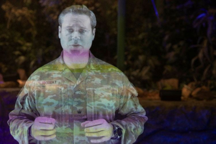
How does it work?
The holographic technology is built on a table, where tracking glasses are worn to show specific angles and views of the battle space. Commanders can then move avatars around and build their ‘design for battle’ interactively from high-definition terrain that has been captured by an unmanned aerial vehicle (UAV) just moments before.
Once they have planned the mission, it can then be shown through a hologram on a wall for soldiers to understand and visually see the plan. The wall hologram is easy to deploy and can be transported by soldiers.
![]() How will the hologram benefit the Army?
How will the hologram benefit the Army?
With the interactive hologram, commanders can understand the exact terrain that can’t be seen on a topographic map. In turn, this helps commanders make more informed decisions.
The hologram technology would allow different teams to operate together, rather than on individual desktops.
We were excited to explore this concept with the Army, and to demonstrate the role industry can have in delivering research and innovation for the Army of tomorrow.
Want to know how NGIS can help your company with the latest technology? Contact us today.
Images sourced: CPL Sagi Biderman, Australian Army.
Related Articles
Here are more related articles you may be interested in.
How Satellite based Earth Observation Supports Emergency Response Teams
Natural disasters are an increasingly familiar reality, yet their unpredictability remains a core challenge. This is why preparedness is our best means of mitigating impact when disaster does occur. Satellite technology plays a critical role in enabling this readiness, but why? To understand this, you need only consider the sheer scale and diversity of Australia’s landscapes, waters and ecosystems. The continent spans 7.7 million square kilometres and, relative to its total area, has a low population density. This…United Nations, Google Cloud and NGIS Team Up to Bring AI-Powered Planning to Communities in Crisis
The United Nations International Organization for Migration (IOM), in partnership with Google Cloud and NGIS are advancing data-driven humanitarian planning through the use of AI and Geospatial powered tools, helping humanitarian organisations to analyse the most vulnerable locations across multiple areas and proactively plan for disaster response, climate driven displacement, and long term community recovery. At the centre of the initiative is the…Celebrating Women in GIS: More than Maps
From tracking deforestation to building geospatial tools from the ground up, the women at NGIS are driving impactful real-world outcomes. This International Women’s Day, we spoke to three women across our Earth Observation, software engineering and spatial analysis solutions, to find out what first attracted them to GIS, what keeps them here, and what they’d tell their younger selves starting out.NGIS joins global space-based solutions provider CLS
Media Release | 27th January 2026 NGIS is excited to announce that the company will now be part of CLS (Collecte Localisation Satellites), a global leader in monitoring and surveillance solutions for our Earth. The acquisition marks a significant milestone for the Australian geospatial sector, bringing together NGIS’ world-class geospatial expertise with CLS Group’s expansive reach and innovative capabilities in space-based solutions. Beyond technology and commercial…


