Coastal risk modelling

LIDAR and imagery data for planning
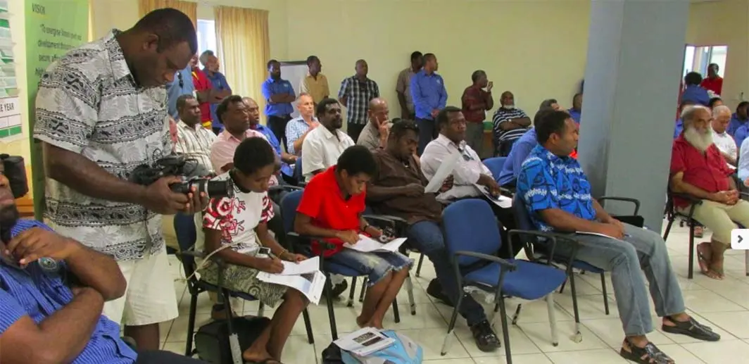
NGIS was engaged by CRCSI (Cooperative Research Centre for Spatial Information) to develop the Pacific Island nations’ capacity to manage and use LiDAR (Light Detection and Ranging) and imagery data in planning assistance for the effects of sea level rise. A specific objective of this CRCSI initiative was for NGIS to support the ongoing sustainability of the data, software and hardware provided to these countries as part of the program. This means that countries are equipped with software and hardware that can be adequately maintained by themselves post-implementation. Throughout 2013, NGIS attended several in-country scoping missions to determine each country’s requirements, and subsequently undertook a series of training programs to build the desired GIS capabilities of each respective government. NGIS also scoped the software and hardware required to effectively use the LiDAR data provided by the project to support this capacity building project.
“NGIS played a critical role in the pacific islands capacity building project. What NGIS offered over and above anyone else in the industry was their proven ability and capacity within GIS training”
Nathan Quadros, Project Director, Education and business development manager, Cooperative research centre for Spatial Information

Coastal areas of low gradient elevation
For coastal communities to adapt resiliently to future sea level rise, stakeholders require a sound understanding of the potential impacts and risks associated with coastal inundation and erosion. For populated coastal areas of low gradient elevation, such as Nuku’alofa in Tonga and the north coast of Papua New Guinea (PNG), high resolution elevation data can improve the accuracy of inundation modelling and the subsequent estimation of risk to infrastructure and communities. Such high resolution elevation data has not been available until now in Tonga, PNG, Vanuatu and Samoa (“the Pacific Islands”). NGIS, in partnership with CRCSI, worked with these communities throughout 2013 to leverage the power of the recently acquired LiDAR data, and ensure it is used in planning for the homes and critical infrastructure at risk of inundation on these islands. Tailored spatial and data management training was developed around existing in-country capacity and the requirements for effectively utilising the LiDAR data.


Coastal risk modelling
By identifying communities most at risk of sea level rise, governments can actively plan for the effects of climate change through spatial modelling and data availability. The Pacific Islands of Tonga, Samoa, Papua New Guinea and Vanuatu all lacked elevation data with the required resolution to perform small scale coastal risk analysis to identify key communities at risk of sea level rise. This program provided a number of data products derived from high resolution LiDAR data including 1m resolution Digital Elevation Models and Digital Surface Models, as well as the raw LiDAR point cloud data. Through the availability and use of this data, inundation modelling was performed. Inundation models were provided for Highest Astronomical Tide, one in ten year storm and one in 100 year storm scenarios for 2030, 2055 and 2090. The information used for the modelling was provided through the Pacific Climate Change Science Program and the Australian Bureau of Meteorology. Each attendee received comprehensive training documentation for the courses they attended, allowing attendees to continue the learning process after the training had been completed.
This approach was complemented by NGIS providing two months’ support to each attendee after the training, empowering them during their initial use of the data. “Having already developed GIS courses for its customers, NGIS was able to tailor those courses for this project and deliver a very high quality training product,” said Quadros.
Community implementation
One of the most significant results from this project was the community acceptance and understanding and uptake of the training and solutions. A direct result of the Pacific islands project was the concept of the Vanuatu Globe, a visualisation tool based on the Google Earth platform which was developed by NGIS and CRCSI. The training and education has enabled a widespread use of the data and the Google Earth solution, which has provided the people of Vanuatu with valuable tools for the planning of emergency response and protection against storm surge. Many Pacific Island countries are implementing a range of measures to mitigate the impacts of storm surge and inundation including sea walls and mangroves. The inundation models for sea level rise provided through this project will allow government ministries to focus policies, planning and development for climate change mitigation through the temporal triggers achieved through localised coastal risk analysis.
‘I would like to say you have come and prove your excelling in your job and you have invested in our lives far greater than you ever thought (becoming map engineers of LiDAR data). Thank you so much’.
Quote from pacific islands training attendees
‘I have learnt a lot by discovering a lot of unknown areas, especially in the field of mapping. The short training has given me an opportunity to see how important maps are and what maps are really used for.’
Quote from pacific islands training attendees
‘The course is really excellent and fantastic as it refers to real life scenarios and how it impact on the health of communities.’
Quote from pacific islands training attendees


