Using GIS to assist
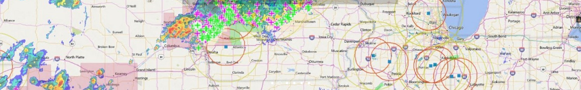
Lightning strike detection
Commercialisation of GIS technology
In 2001, NGIS' research and development department developed GeoSamba, a framework for rapidly deploying smart web mapping applications that integrate business information. Powerful interfaces, scalable service architecture and a flexible licensing model made GeoSamba the ideal tool for sharing information on maps to project teams, across departments and throughout large enterprises.
In the post-9/11 world of security-focused government, NGIS was engaged to use the technology to help provide up to date information on the energy assets of Australia. The Cooperative Research Centre for Spatial Information and NGIS worked on a research project to develop a common operating picture for emergency response systems. The tool would be an up to date picture with moving threat information.
The tracking of human and natural hazards to critical infrastructure led NGIS to commercialise Indji Systems with a focus on tracking wind and lightning hazards. Based on GeoSamba technology, Indji Watch was developed. With capital raised and a new company formed, Indji Systems achieved 100% market penetration, including the regulator in Australia. With an eye on the world, Indji Systems expanded to the United States, where the market was significantly larger for wind turbines.
Detecting strikes, reducing inspection costs
Early detection of a lighting strike is crucial to reducing overall repair and operating costs of wind turbines. Wind turbines are often in remote locations and may need to be inspected after a weather event. Lightning strike can damage turbine blades leading to catastrophic failure.
Turbines are costly to repair and the volume, distance between them and difficulty/cost of inspection after a possible lightning event means you need to prioritise where you spend your effort. Detecting damage early through targeted inspections can save significant amounts for owner operators. Reports and images generated by Indji Systems offer simple documentation of events useful for insurance and end of warranty issues arising from storm damage.

Wind farm operators find 25-30% more damaged blades when using historical lightning data instead of just doing blanket ground searches.
Marty McKewon, Indji sysyems
Using GIS to prioritise inspection
Indji goes beyond the standard levels of lightning strike prediction accuracy, which usually has a 250 - 400 metre error margin. Indji Watch has a sophisticated confidence ellipse system that helps turbine operators accurately predict when a turbine has been hit so they can authorise an inspection with confidence. Using a map to show where lightning strikes probably occurred helps operators prioritise which sites to inspect first.
Wind farm operators find 25 - 30% more damaged blades when using historical lightning data instead of just doing blanket ground searches. To address uncertainty, Indji Watch shows the client’s entire wind farm to let users interrogate storm data to determine possible impacts.
Learn more about
Quicklinks